
Surface elevation 581 feet (177 m) | ||
 | ||
Similar Lake Michigan, Sleeping Bear Dunes N, Torch Lake, Mission Point Light, Grand Traverse Light | ||
Storm over west grand traverse bay
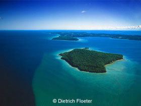
Grand Traverse Bay is a bay of Lake Michigan formed by the Leelanau Peninsula in the northwestern Lower Peninsula of Michigan. The bay is 32 miles (51 km) long, 10 mi (16 km) wide, and up to 620 feet (190 m) deep in spots. It is divided into two arms by the Old Mission Peninsula. The entire bay is conterminous with the Grand Traverse Bay Bottomland Preserve. It should not be confused with Grand Traverse Bay of Lake Superior, located on the Keweenaw Peninsula.
Contents
- Storm over west grand traverse bay
- Map of Grand Traverse Bay Michigan USA
- Flying over traverse city michigan grand traverse bay sleeping bear dunes national lakeshore
- CommunitiesEdit
- References
Map of Grand Traverse Bay, Michigan, USA
Traverse City is situated at the south end of the bay where the Boardman River empties into the west arm. Cherry orchards line the bay region, giving rise to Traverse City's claim to be the Cherry Capital of the World. Several nationally known companies offer cherry-based products made with Northern Michigan tart cherries including Traverse Bay Farms, Cherry Central, Fruit Advantage, American Spoon, Cherry Republic and Old Mission Traders (formerly Cherry Stop). The region is the center of cherry production in Michigan.
The Grand Traverse Bay includes an East and West arm and several important smaller bays: Northport Bay, Suttons Bay, Omena Bay, Bowers Harbor, and Old Mission Bay. Northport Bay, located at the northwest corner of Grand Traverse Bay is about 10 mi (16 km) long and 4 miles (6.4 km) wide. Northport Bay open to the east, except inside the arms at each end, with the Leelanau Peninsula on the West side. There are several shoals in Northport Bay marked by buoys. Bellows Island, a low gravel island covered by shrubs and located near the middle of Northport Bay, is owned by the Nature Conservancy; it is primarily known as a bird rookery, and is sometimes locally called Gull Island.
The Village of Northport, Michigan operates a public marina. There is a public beach on the south side of the marina. The bay is lined with homes. There are two boat yards north of town. There is a private marina on the southerly end of the bay.
Besides cherries, the surrounding countryside produces grapes and is one of the centers of the Michigan wine industry. Known for its shimmering blue water and golden sand beaches, the Grand Traverse Bay region is a popular vacation destination.
In September 2007, Mark Holley, an underwater archeologist with the Grand Traverse Bay Underwater Preserve Council who teaches at Northwestern Michigan College in Traverse City, said that they might have discovered a boulder 3.5 to 4 feet (1.1 to 1.2 m) high x 5 feet (1.5 m) long) with a prehistoric carving in the Grand Traverse Bay. The granite rock has markings that resemble a mastodon with a spear in its side. Confirmation that the markings are an ancient petroglyph will require more evidence. The stone is pictured on page 9 of New Scientist Magazine of 19 July 2008.