
Country United States Time zone CST (UTC-6) Elevation 110 m Local time Saturday 4:19 AM | Established November 4, 1884 ZIP codes 62940, 62942, 62966 Area 86.56 km² Population 707 (2010) | |
 | ||
Weather 9°C, Wind NW at 11 km/h, 70% Humidity | ||
Grand Tower Township is one of sixteen townships in Jackson County, Illinois, USA. As of the 2010 census, its population was 707 and it contained 336 housing units.
Contents
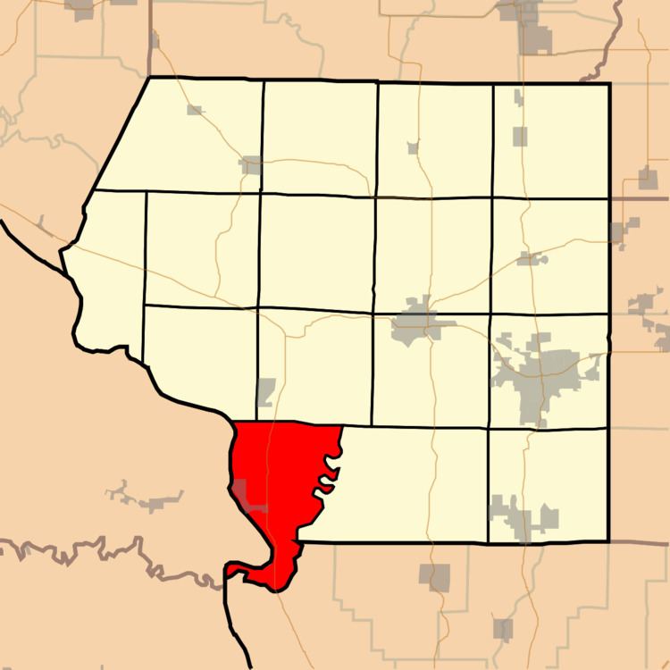
- Map of Grand Tower Township IL USA
- Geography
- Cities towns villages
- Unincorporated towns
- Adjacent townships
- Cemeteries
- Major highways
- Rivers
- School districts
- Political districts
- References
Map of Grand Tower Township, IL, USA
Geography
According to the 2010 census, the township has a total area of 33.42 square miles (86.6 km2), of which 31.56 square miles (81.7 km2) (or 94.43%) is land and 1.86 square miles (4.8 km2) (or 5.57%) is water.
A small portion of Missouri, known as Grand Tower Island, lies on the Mississippi River's eastern side adjacent to Grand Tower Township. Partially surrounded by an oxbow lake, the island can only be accessed by water or by a road that begins and ends in Illinois.
Cities, towns, villages
Unincorporated towns
(This list is based on USGS data and may include former settlements.)
Adjacent townships
Cemeteries
The township contains these four cemeteries: Goodbread, Henson, Hudson and Walker Hill.