
Prominence 1,053 m | Elevation 2,977 m First ascent 16 August 1859 | |
 | ||
Easiest route Via refuge Jean Collet and the Lac Blanc Similar Croix de Belledonne, Grande Lauzière, Rocher Blanc, Grandes Rousses, Chamechaude | ||
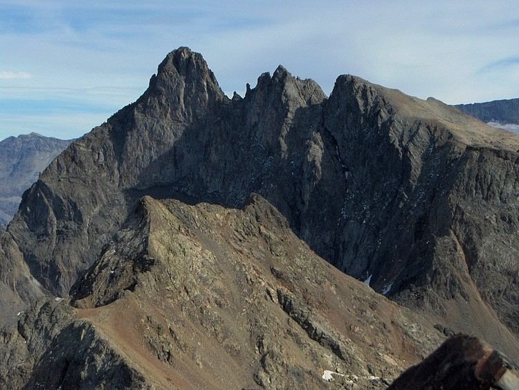
Grand pic de belledonne 2 977m
The Grand Pic de Belledonne is the highest mountain in the Belledonne massif in the Dauphiné Alps at 2,977 metres (9,767 ft).
Contents
- Grand pic de belledonne 2 977m
- Map of Grand Pic de Belledonne 38114 Sainte AgnC3A8s France
- Face est du grand pic de belledonne yap prod 28 29 avril 2016
- Geography
- History
- References
Map of Grand Pic de Belledonne, 38114 Sainte-Agn%C3%A8s, France
Face est du grand pic de belledonne yap prod 28 29 avril 2016
Geography
Situated in the French department of Isère, the Grand Pic of Belledonne dominates the valley of Grésivaudan and partners the Pic Central of Belledonne and the Croix de Belledonne. These three summits dominate the Freydane glacier.
History
Étienne Favier performed the first ascent dates on 16 August 1859, via the valley of Eau d'Olle and the Lac De Belledonne. He repeated that ascent on 17 August 1873 with his son, Émile Viallet and Auguste Michel.
In 1875, the Société des Touristes du Dauphiné constructed the refuge of Belledonne (now in ruins) above the "lac de Belledonne".
The corridor separating the Grand Peak from the Central peak is named after the alpinist Auguste Reynier who, in 1891, made the first climb via the Freydane glacier.
Gaston Rébuffat was the first to climb the mountain from the north in 1944, accompanied by Michel Chevalier.