
Population 4,213 (2011 census) | Postcode(s) 4075 Postal code 4075 | |
 | ||
Location 8 km (5 mi) from Brisbane GPO State electorate(s) Electoral district of Indooroopilly | ||
Graceville is a suburb in Brisbane, Queensland, Australia. It is located 7.8 kilometres (4.8 mi) south-west of the Brisbane CBD. Graceville is bordered by the Brisbane River to the North-East and West, Oxley Creek to the East, Chelmer to the North and Sherwood to the South. At the 2011 Australian Census the suburb recorded a population of 4,213.
Contents
- Map of Graceville QLD 4075 Australia
- Demographics
- Landmarks and architecture
- Heritage listings
- References
Map of Graceville QLD 4075, Australia
The suburb is centred on its own railway station on the Ipswich railway line. The suburb is predominantly residential, with houses generally being in the Queenslander style. The main roads in Graceville are Oxley Road, Graceville Avenue and Honour Avenue. Graceville has two primary schools, Graceville State School and Christ the King which is a private Catholic school. The suburb also has a number of parks (Simpson's Playground, Graceville Memorial Park, Faulkner Park).
Graceville also houses a number of sporting clubs, such as Souths Graceville Lions Rugby League Club, South West United Hockey Club, West Taylor Bridge Rugby Club, Rangers Netball Club, Western Suburbs Cricket Club and Graceville Amateur Swimming Club, which is based at Graceville State School.
Demographics
In the 2011 census, Graceville recorded a population of 4,213 people, 51.7% female and 48.3% male. The median age of the Graceville population was 37 years of age, the same as the national median. 77.1% of people living in Graceville were born in Australia, compared to the national average of 69.8%; the next most common countries of birth were England 4.4%, New Zealand 2.9%, United States of America 1.1%, Scotland 0.9%, South Africa 0.8%. 89.4% of people spoke only English at home; the next most popular languages were 0.8% Vietnamese, 0.7% Mandarin, 0.6% Polish, 0.5% German, 0.5% Cantonese.
Landmarks and architecture
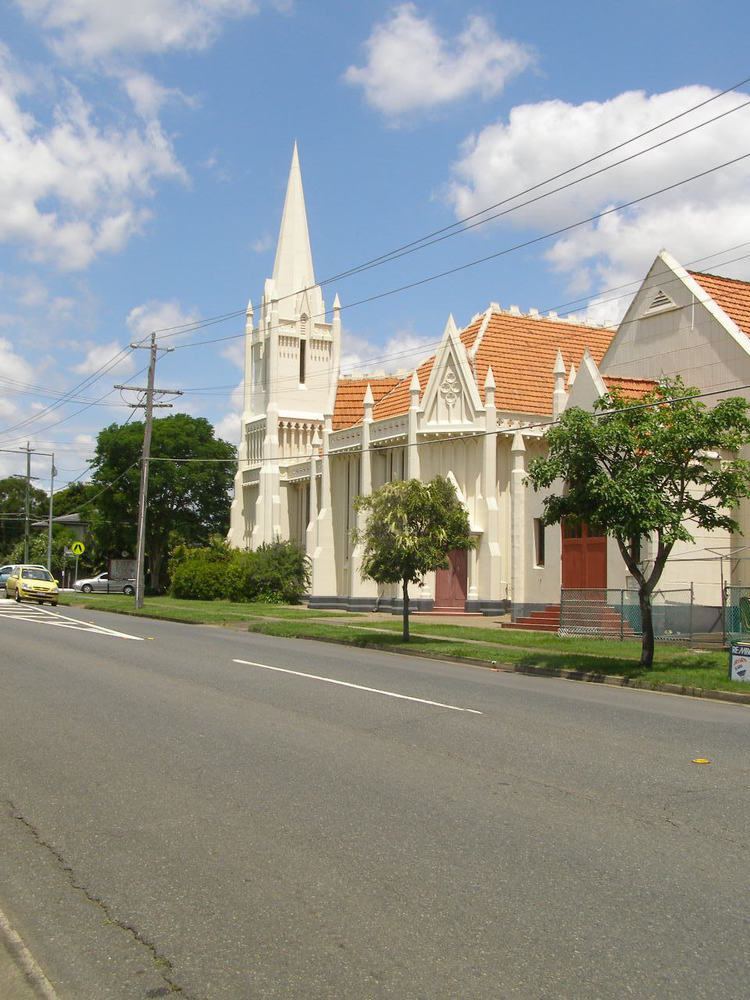
One of Graceville's most recognisable landmarks is the Graceville Uniting Church, on the intersection of Oxley Road and Verney Road East. The church was completed in 1930 and designed and built by local contractor Walter Taylor who was responsible for many local landmarks including the Walter Taylor Bridge which was named after him. Another landmark is the Graceville Memorial Oval, which has the Memorial for the soldiers who died in wars that lived in the area.
Heritage listings
Graceville has a number of heritage-listed sites, including: