
Area 75.72 km2 | Language spoken Aw Mayor Naason Kubuya Ndoole | |
 | ||
Country | ||
Map of Goma
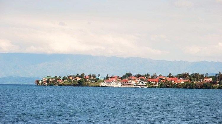
Goma is the capital city of North Kivu province in the eastern Democratic Republic of the Congo. It is located on the northern shore of Lake Kivu, next to the Rwandan city of Gisenyi. The lake and the two cities are in the Albertine Rift, the western branch of the East African Rift system. Goma lies only 13 to 18 km due south of the crater of the active Nyiragongo Volcano. The recent history of Goma has been dominated by the volcano and the Rwandan Genocide of 1994, which in turn fuelled the First and Second Congo Wars. The aftermath of these events was still having effects on the city and its surroundings in 2010. The city was captured by rebels during the M23 rebellion in late 2012, but has since been retaken by government forces.
Contents
- Map of Goma
- Makulo in zanzibar by nuria goma
- World best hotels and tourism in goma and butembocongokinshasa
- Goma at the centre of the refugee crisis
- Goma in the First Congo War
- Goma in the Second Congo War
- Conflict since the end of the war
- Politics
- Volcanic activity around Goma
- 2002 Eruption of Nyiragongo
- The threat posed by Lake Kivu
- Transport
- Climate
- Other features of Goma
- Dr congo goma food distribution
- References
Makulo in zanzibar by nuria goma
World best hotels and tourism in goma and butembocongokinshasa
Goma at the centre of the refugee crisis
The Rwandan Genocide of 1994 was perpetrated by the provisional Rwandan government on the Tutsi, population and Hutu moderates. In response the Rwandan Patriotic Front (RPF), formed by Tutsi refugees in Uganda, which already controlled large areas of northern Rwanda following its 1990 invasion and the ongoing Civil War, overthrew the Hutu government in Kigali and forced it. One of the many UN missions attempted to provide a safe zone in the volatile situation and provided safe passage for the refugees, however they were French. From June 13 to July 14, 1994, 10,000 to 12,000 refugees per day crossed the border into Goma. The massive influx created a severe humanitarian crisis, as there was an acute lack of shelter, food and water. However the Zaïrean government took it upon themselves to garner attention for the situation. Shortly after the arrival of nearly one million refugees, a deadly cholera outbreak claimed thousands of lives in the Hutu refugee camps around Goma. RPF aligned forces, manly actors in the conflict, crossed the border and in acts of revenge also claimed several lives.
Goma in the First Congo War
Hutu militias and members of the Hutu provisional government were among the refugees, and they set up operations from the camps around Goma attacking ethnic Tutsis in the Kivus and Rwandan government forces at the border. For political reasons the Kinshasa government of the then Zaire led by Joseph Mobutu did not prevent the attacks, and so the Rwandan government and its Ugandan allies threw their support behind the Alliance of Democratic Forces for the Liberation of Zaire, a rebel movement led by Laurent Kabila against Mobutu. Rwandan forces stormed the camps at Goma, resulting in thousands of additional deaths, and with their help and that of Uganda, Kabila went on to overthrow Mobutu's regime in the First Congo War, which ended in 1997.
Goma in the Second Congo War
Within a year Kabila had quarrelled with his former allies, and in 1998 the Rwandan government backed a Goma-based rebel movement against Kabila, the Congolese Rally for Democracy (RCD, sometimes called RCD-Goma) made of Banyamulenge people, related to the Tutsis. They captured Bukavu and other towns, and the Second Congo War began. The Goma refugee camps, in which the Hutu had created a militia called the FDLR (Democratic Force for the Liberation of Rwanda), were again attacked by Rwandan government forces and the RCD.
The Second Congo War was unprecedented in Africa for the loss of civilian life in massacres and atrocities. By 2003 the Banyamulenge had become tired of the war and friction emerged between them and Rwanda. In 2002 and 2003 a fragile negotiated peace emerged between the many sides involved in the war.
Conflict since the end of the war
There have been numerous outbreaks of violence since 2003. The Hutu FDLR remains in the forests and mountains north and west of Goma, carrying out attacks on the Rwandan border and on the Banyamulenge. The Congolese defence forces are unable or unwilling to stop them, and as a consequence Rwanda continues to support Banymulenge rebels such as the RCD and General Nkunda, and to carry out incursions into North Kivu in pursuit of the FDLR.
In September 2007 large-scale fighting threatened to break out again as the 8,000-strong militia of General Nkunda, based around Rutshuru, broke away from integration with the Congolese army and began attacking them in the town of Masisi north-west of Goma. MONUC (United Nations Mission in the Democratic Republic of Congo) began airlifting Congolese troops into Goma and transferring them by helicopter from Goma International Airport to Masisi.
On October 27, 2008, the Battle of Goma broke out in the city between the Congolese army, supported by MONUC, and Nkunda's CNDP rebels; 200,000 refugees fled the town.
Goma was seized by the M23 movement on November 20, 2012. "Tens of thousands" of civilians fled the area.
Politics
Goma is represented in the National Assembly by six deputies:
Volcanic activity around Goma
The Great Rift Valley is being pulled apart, leading to earthquakes and the formation of volcanoes in the area.
2002 Eruption of Nyiragongo
In January 2002, Nyiragongo erupted, sending a stream of lava 200 metres (219 yd) to one kilometre (1,100 yd) wide and up to two metres (6½ ft) deep through the center of the city as far as the lake shore. Agencies monitoring the volcano were able to give a warning and most of the population of Goma evacuated to Gisenyi. The lava destroyed 40% of the city (more than 4,500 houses and buildings). There were some fatalities caused by the lava and by emissions of carbon dioxide, which causes asphyxiation. The lava also covered over the northern 1 km of the 3-kilometre (10,000 ft) runway of Goma International Airport, isolating the terminal and apron which were at that end. The lava can easily be seen in satellite photographs, and aircraft can be seen using the 2-km (6,500-ft) southern section of the runway which is clear of lava.
In 2005, volcanic activity again threatened the city.
Currently the scientists at Goma are monitoring Nyiragongo.
The threat posed by Lake Kivu
Lake Kivu is one of three lakes in Africa identified as having huge quantities of dissolved gas held at pressure in its depths. Two of the others, Lake Monoun and Lake Nyos, experienced a limnic eruption or 'lake overturn', a catastrophic release of suffocating carbon dioxide probably triggered by landslides. Lake Nyos overturn was particularly lethal, killing nearly two thousand people in the area around the lake. Kivu is 2,000 times bigger than Lake Nyos and also contains dissolved methane as an additional hazard - though concentration of carbon dioxide is much lower than in Lake Nyos. Nearly two million people, including the population of Goma, live in the vicinity of Lake Kivu and could be in danger from a limnic eruption triggered by one of the nearby volcanoes and the earthquakes associated with them.
The phenomena known locally as 'mazuku' has killed children even more recently.
Transport
Goma International Airport provides domestic flights and, as of 2016, one international flight. The city lies on the Rwandan border and neighboring Gisenyi is connected to Kigali, the Rwandan capital, by road and regular buses travel between these cities in under four hours. Goma is connected to Bukavu by ferries, to Butembo, Beni, Bunia and Kisangani either by domestic flights or by road, and regular buses travel from Goma to these cities. It takes one to two days of travel,(by bus) to arrive in those cities. Security concerns on this road {Grand Nord Adventure} is more and more arranged since 2016 by local authorities.
Climate
Köppen-Geiger climate classification system classifies its climate as a tropical savanna climate (Aw).