
Country United States County BrownWatonwan ZIP code 56081 Elevation 318 m | Time zone Central (CST) (UTC-6) Area code(s) 507 Local time Wednesday 7:21 PM | |
 | ||
Weather -3°C, Wind SE at 18 km/h, 72% Humidity | ||
Godahl is an unincorporated community in Brown and Watonwan counties in the U.S. state of Minnesota.
Contents
Map of Godahl, Nelson Township, MN 56081, USA
Location
Godahl sits on the boundary line for Brown and Watonwan counties, occupying two counties. The community is located between Sleepy Eye and St. James on Minnesota State Highway 4. The community is located at the junction of Minnesota State Highway 4 with County Roads 6 and 10.
History
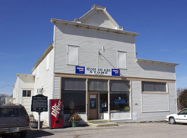
Godahl was settled by Norwegian immigrants and named in honor of their home, called Gode Dahl ("Good Valley"). The town had a post office from 1894 until 1907, and a station of the Chicago, St. Paul, Minneapolis and Omaha Railway. The community failed to develop, and for many years the only remnant of its commercial aspirations was the cooperative store built in 1894. The store closed on December 31, 2016.