
Country United States FIPS code 27-60844 Elevation 312 m Population 3,503 (2013) Area code 507 | Time zone Central (CST) (UTC-6) GNIS feature ID 0652150 Zip code 56085 Local time Thursday 10:34 PM | |
 | ||
Weather 4°C, Wind E at 8 km/h, 86% Humidity Area 5.232 km² (4.532 km² Land / 70 ha Water) | ||
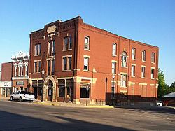
Sleepy Eye is a city in Brown County, Minnesota, United States. The population was 3,599 at the 2010 census.
Contents
- Map of Sleepy Eye MN 56085 USA
- History
- Geography
- 2010 census
- 2000 census
- Events
- Pop culture
- Transportation
- Notable people
- References
Map of Sleepy Eye, MN 56085, USA
History
Sleepy Eye took its name from Sleepy Eye Lake, and that was named after Chief Sleepy Eye who was known as a compassionate person with droopy eyelids (or maybe just one). The Chief was one of four Sioux Native Americans (four Ojibwe also attended) chosen to meet President James Monroe in 1824 in the nation's capital. Later, Sleepy Eye was an integral player in the 1851 signing of the Treaty of Traverse des Sioux, which gave all of the land but a 10-mile swath on each side of the upper Minnesota River to the U.S. government. His recommendations to traders led to the successful settlement of Mankato, away from flood areas, and the Chief eventually settled his people near the lake now known as Sleepy Eye Lake.
Sleepy Eye was platted in 1872, and incorporated as a city in 1903.
Geography
According to the United States Census Bureau, the city has a total area of 2.02 square miles (5.23 km2), of which 1.75 square miles (4.53 km2) is land and 0.27 square miles (0.70 km2) is water.
2010 census
As of the census of 2010, there were 3,599 people, 1,475 households, and 931 families residing in the city. The population density was 2,056.6 inhabitants per square mile (794.1/km2). There were 1,605 housing units at an average density of 917.1 per square mile (354.1/km2). The racial makeup of the city was 94.3% White, 0.1% Native American, 0.9% Asian, 4.1% from other races, and 0.7% from two or more races. Hispanic or Latino of any race were 13.0% of the population.
There were 1,475 households of which 30.1% had children under the age of 18 living with them, 51.4% were married couples living together, 8.3% had a female householder with no husband present, 3.4% had a male householder with no wife present, and 36.9% were non-families. 33.4% of all households were made up of individuals and 17.8% had someone living alone who was 65 years of age or older. The average household size was 2.36 and the average family size was 3.04.
The median age in the city was 42.2 years. 25.6% of residents were under the age of 18; 6.5% were between the ages of 18 and 24; 21.1% were from 25 to 44; 27.3% were from 45 to 64; and 19.4% were 65 years of age or older. The gender makeup of the city was 47.4% male and 52.6% female.
2000 census
As of the census of 2000, there were 3,515 people, 1,479 households, and 942 families residing in the city. The population density was 2,099.9 people per square mile (812.7/km²). There were 1,591 housing units at an average density of 950.5 per square mile (367.8/km²). The racial makeup of the city was 94.03% White, 0.23% African American, 0.06% Native American, 0.34% Asian, 3.90% from other races, and 1.45% from two or more races. Hispanic or Latino of any race were 7.80% of the population.
There were 1,479 households out of which 31.8% had children under the age of 18 living with them, 53.3% were married couples living together, 7.3% had a female householder with no husband present, and 36.3% were non-families. 34.5% of all households were made up of individuals and 19.8% had someone living alone who was 65 years of age or older. The average household size was 2.37 and the average family size was 3.08.
In the city, the population was spread out with 28.0% under the age of 18, 6.8% from 18 to 24, 26.0% from 25 to 44, 19.9% from 45 to 64, and 19.3% who were 65 years of age or older. The median age was 38 years. For every 100 females there were 92.5 males. For every 100 females age 18 and over, there were 87.3 males.
The median income for a household in the city was $37,123, and the median income for a family was $48,500. Males had a median income of $31,612 versus $22,907 for females. The per capita income for the city was $20,175. About 4.7% of families and 8.1% of the population were below the poverty line, including 10.7% of those under age 18 and 10.2% of those age 65 or over.
Events
Pop culture
Residents of Sleepy Eye made national headlines in the early 1990s for trying to ban MTV in the town.
On the television series Little House on the Prairie, Charles Ingalls sometimes made deliveries to Sleepy Eye, which was portrayed as the nearest larger town to Walnut Grove, where the Ingalls resided. It was also the (fictional) home of the blind school that Mary Ingalls and her TV-husband, Adam Kendall, ran later in the series.
Transportation
U.S. Route 14 and Minnesota State Highways 4, and 68 are three of the main arterial routes in the city.