Postal code 17-123 Area 70.21 km² | County Bielsk Time zone CET (UTC+1) Area code(s) +48 085 Population 2,170 (2007) | |
 | ||
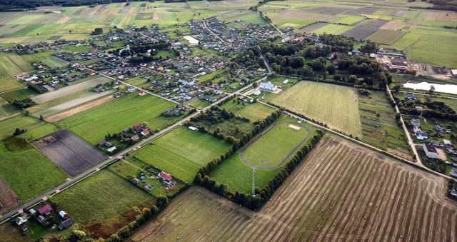
Gmina Rudka [ˈrudka] is a rural gmina (Polish:gmina wiejska) in Bielsk County, Podlaskie Voivodeship. It is located in north-eastern Poland.
Contents
- Map of Gmina Rudka Poland
- Geography
- Location
- Climate
- Rivers
- Demographics
- Municipal government
- Executive branch
- Legislative branch
- Villages
- Neighbouring political subdivisions
- Roads and highways
- Local attractions
- Nearby attractions
- References
Map of Gmina Rudka, Poland
Geography
Gmina Rudka is located in the geographical region of Europe known as the Wysoczyzny Podlasko – Bialoruskie (English: Podlaskie and Belarus Plateau) and the mezoregion known as the Równina Bielska (English: Bielska Plain).
The gmina covers an area of 70.21 square kilometres (27.1 sq mi).
Location
It is located approximately:
Climate
The region has a continental climate which is characterized by high temperatures during summer and long and frosty winters . The average amount of rainfall during the year exceeds 550 millimetres (21.7 in).
Rivers
Two rivers pass through the Gmina:
Demographics
Detailed data as of 31 December 2007:
Municipal government
Its seat is the village of Rudka.
Executive branch
The chief executive of the government is the mayor (Polish: wójt).
Legislative branch
The legislative portion of the government is the Council (Polish: Rada) comprising the President (Polish: Przewodniczący), the Vice-President (Polish: Wiceprzewodniczący) and thirteen councilors.
Villages
The following villages are contained within the gmina:
Józefin, Karp, Koce Borowe, Niemyje-Jarnąty, Niemyje-Skłody, Niemyje-Ząbki, Nowe Niemyje, Rudka, Stare Niemyje.
Neighbouring political subdivisions
Gmina Rudka is bordered by the town of Brańsk and by the Gminy of Brańsk, Ciechanowiec, Grodzisk and Klukowo.
Roads and highways
A Voivodeship Road passes through Gmina Rudka:
