
Seat Krzeszów Area 62.38 km² | ||
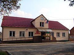 | ||
Gmina Krzeszów is a rural gmina (administrative district) in Nisko County, Subcarpathian Voivodeship, in south-eastern Poland. Its seat is the village of Krzeszów, which lies approximately 21 kilometres (13 mi) south-east of Nisko and 48 km (30 mi) north-east of the regional capital Rzeszów.
Contents
Map of Gmina Krzesz%C3%B3w, Poland
The gmina covers an area of 62.38 square kilometres (24.1 sq mi), and as of 2006 its total population is 4,227 (4,289 in 2013).
Villages
Gmina Krzeszów contains the villages and settlements of Bystre, Kamionka, Koziarnia, Krzeszów, Krzeszów Dolny, Kustrawa, Łazów, Podolszynka Ordynacka, Podolszynka Plebańska and Sigiełki.
Neighbouring gminas
Gmina Krzeszów is bordered by the gminas of Harasiuki, Kuryłówka, Leżajsk, Nowa Sarzyna, Potok Górny, Rudnik nad Sanem and Ulanów.
References
Gmina Krzeszów Wikipedia(Text) CC BY-SA