Population 10,405 (2006) | Area 78.11 km² | |
 | ||
Website | ||
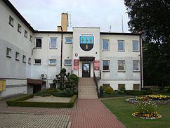
Gmina Konopiska is a rural gmina (administrative district) in Częstochowa County, Silesian Voivodeship, in southern Poland. Its seat is the village of Konopiska, which lies approximately 12 kilometres (7 mi) south-west of Częstochowa and 53 km (33 mi) north of the regional capital Katowice.
Contents
Map of Gmina Konopiska, Poland
The gmina covers an area of 78.11 square kilometres (30.2 sq mi), and as of 2006 its total population is 10,405.
The gmina contains part of the protected area called Upper Liswarta Forests Landscape Park.
Villages
Gmina Konopiska contains the villages and settlements of Aleksandria, Aleksandria Druga, Hutki, Jamki, Konopiska, Kopalnia, Korzonek, Kowale, Łaziec, Leśniaki, Rększowice, Walaszczyki, Wąsosz and Wygoda.
Neighbouring gminas
Gmina Konopiska is bordered by the city of Częstochowa and by the gminas of Blachownia, Boronów, Herby, Poczesna, Starcza and Woźniki.
