
- elevation 1,190 m (3,904 ft) - elevation 38 m (125 ft) | ||
 | ||
Sources Gloucester Tops Road, Great Dividing Range | ||
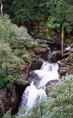
Gloucester River (/ˈɡlɒstər/ GLOS-tər), a perennial river and major tributary of the Manning River catchment, is located in the Upper Hunter district of New South Wales, Australia.
Contents
Map of Gloucester River, New South Wales, Australia
Course and features
Gloucester River rises within Gloucester Tops, on the eastern slopes of the Great Dividing Range, north northwest of Dungog, and flows generally east northeast, joined by six tributaries including the Avon, Barrington, and Bowman rivers, before reaching its confluence with the Manning River, west of Wingham. The river descends 1,150 metres (3,770 ft) over its 102 kilometres (63 mi) course.
The headwaters of the river originate in the World Heritage Barrington Tops region, flowing through the Barrington Tops National Park comprising Antarctic Beech and Southern Sassafras high altitude rainforest. In the middle and lower reaches, the river flows through subtropical rainforest that includes Red Cedar and Rosewood trees.