
Area rank 104 in Norway Area 1,031 km² | Demonym(s) Gloppar Population 5,676 (2012) | |
 | ||
Weather 3°C, Wind W at 18 km/h, 86% Humidity | ||
Gloppen is a municipality in the county of Sogn og Fjordane, Norway. It is located in the traditional district of Nordfjord. Gloppen is generally subdivided into three areas: Hyen in the west, Gloppen in the center, and Breim in the east.
Contents
- General information
- Name
- Coat of arms
- Churches
- Government
- Municipal council
- Mayor
- Geography
- Economy
- Karnilshaugen
- References
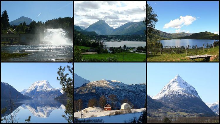
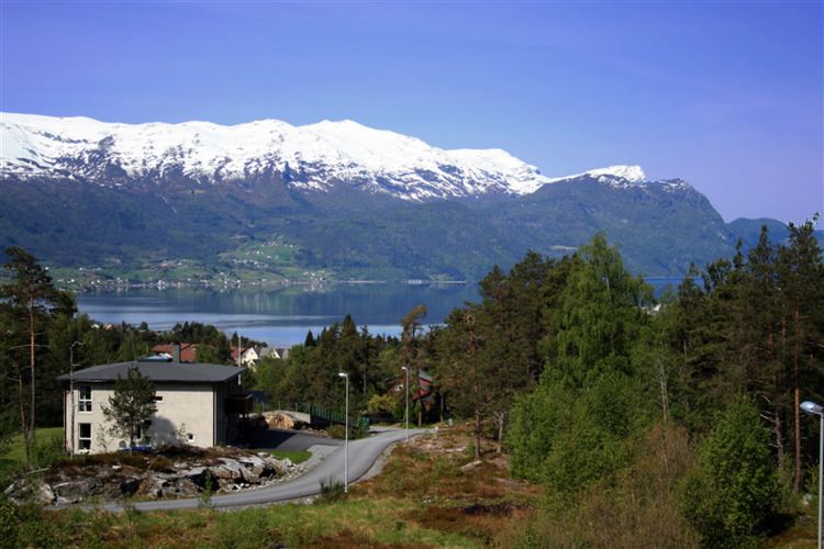
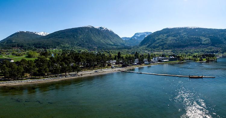
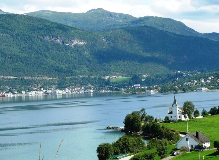
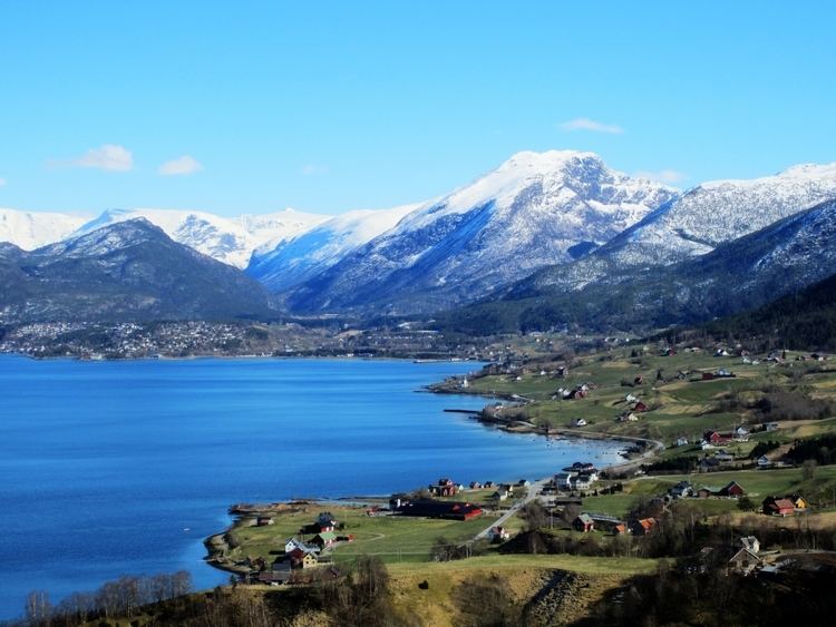
Each of the areas have their own main service centres. Sandane, the administrative centre, is the largest with about 2,500 inhabitants. Sandane, Vereide, and Sørstranda are centered on the Gloppefjorden in Gloppen in the central part of the municipality. The villages of Byrkjelo, Re, Kandal, and Egge are centered on the lake Breimsvatnet in the Breim area in the east. The villages of Straume, Eimhjellen, and Solheim are located around the Hyefjorden in Hyen in the west. The whole municipality sits on the southern side of the Nordfjorden.
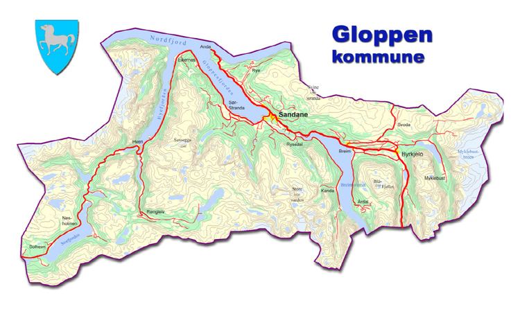
The European route E39 highway runs through the municipality before crossing the Nordfjorden on a car ferry. The Sandane Airport, Anda is located along the E39 highway, just north of Vereide.
General information
Gloppen was established as a municipality on 1 January 1838 (see formannskapsdistrikt). The original municipality was identical to the Gloppen parish (prestegjeld) including the sub-parishes (sokn) of Gimmestad, Breim, and Vereide.
On 1 January 1886, the sub-parish of Breim (population: 1,823) was separated from Gloppen to form its own municipality. This left Gloppen with 2,970 residents. On 1 January 1964, the municipality of Breim (population: 1,731) was merged back into the municipality of Gloppen. After the merger, the population of Gloppen was 5,702. On 1 January 1965, the Hoplandsgrenda area (population: 42) of Gloppen municipality (on the northern shore of the Nordfjorden) was transferred to neighboring Stryn Municipality. On 1 January 1992, the Lote area of Gloppen (also on the north side of the Nordfjorden) was transferred to Eid Municipality. This left all of Gloppen located south of the Nordfjorden.
Name
The name (Old Norse Gloppi) was originally the name of a fjord (now Gloppefjorden). The name is probably derived from the word gloppa which means "narrow opening".
Coat of arms
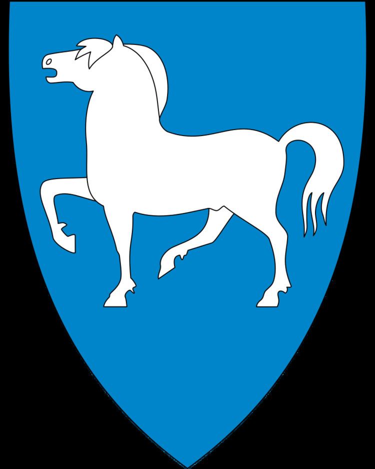
The municipal coat of arms were granted on 19 December 1986. It shows a silver-colored fjord horse on a blue background. This was chosen since these horses are bred in the area.
See also: Coats-of-arms for Eid, Levanger, Lyngen, Nord-Fron, Skedsmo and Ski municipalitiesChurches
The Church of Norway has four parishes (sokn) within the municipality of Gloppen. It is part of the Nordfjord deanery in the Diocese of Bjørgvin.
Government
All municipalities in Norway, including Gloppen, are responsible for primary education (through 10th grade), outpatient health services, senior citizen services, unemployment and other social services, zoning, economic development, and municipal roads. The municipality is governed by a municipal council of elected representatives, which in turn elect a mayor.
Municipal council
The municipal council (Kommunestyre) of Gloppen is made up of 27 representatives that are elected to every four years. For 2011–2015, the party breakdown is as follows:
Mayor
The mayor (ordførar) of a municipality in Norway is a representative of the majority party of the municipal council who is elected to lead the council. Anders Ryssdal of the Centre Party (Senterpartiet) was re-elected mayor for the 2011–2015 term. He was first elected mayor in 1999.
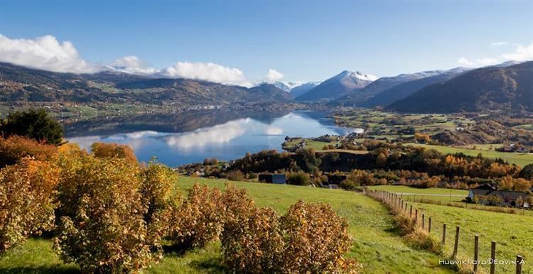
Geography
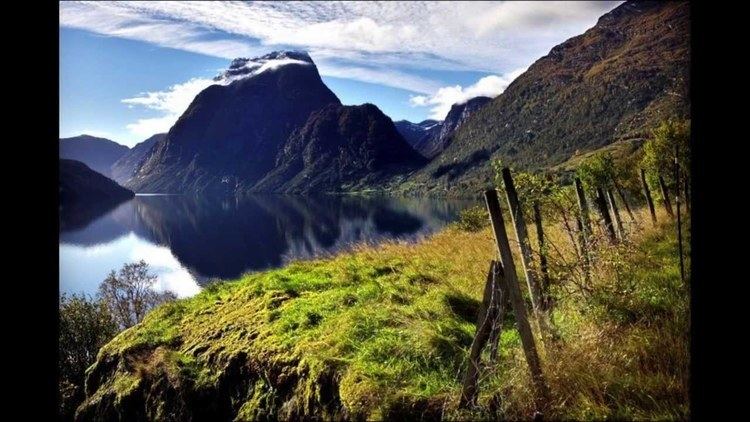
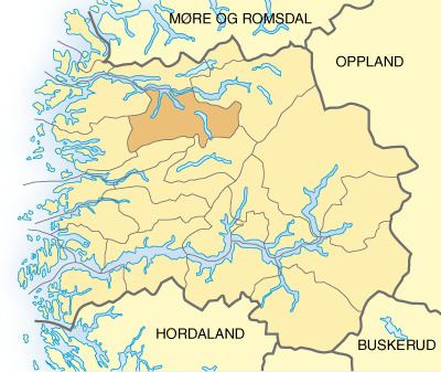
The municipality is located southern shores of the Nordfjorden. To the north is the municipality of Eid, to the east is Stryn, to the south is Naustdal and Jølster, and to the west is Flora and Bremanger. There are two fjords that branch off the main fjord into Gloppen: Hyefjorden and Gloppefjorden.
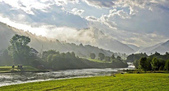
Gloppen has a natural landscape with virtually unspoiled nature ranging from sea level up to high-alpine mountains of some 1,800 metres (5,900 ft) height. Snønipa is the highest mountain in the municipality and is located at the Myklebustbreen glacier. The lakes Breimsvatn and Emhjellevatnet are, respectively, the first and second largest lakes in Gloppen. There are also some large glaciers such as Ålfotbreen, Gjegnalundsbreen, and Myklebustbreen.
There is a river, Gloppeelva.
Economy
The dominant trades and industries in Gloppen are agriculture and farming. The municipal centre Sandane is also home to a college of secondary education and, until 2005, a branch of Sogn og Fjordane University College which specialized in music therapy. The Firda Upper Secondary School is located in Sandane.
Karnilshaugen
Gloppen is the site of Karnils tumulus burial mound (Norwegian: Karnilshaugen) from the Old Norse word haugr meaning mound or barrow. Karnilshaugen or Tinghaugen på Hauge is located on the Hauge farm west of Sandane. Karnilshaugen is probably one of the ten largest mounds in Nordfjord. The burial mound was built on top of Tinghaug, the site of a Thing (assembly). Tinghaug was a place of public gathering, for cultural events and religious actions.