
Elevation 3,721 m | Prominence 125 m | |
 | ||
Isolation 0.789 km → Großglockner First ascent 3 September 1872 by Josef Pöschl guided by Josef Kerer and Peter Groder Easiest route from the Stüdl Hut over the Teischnitzkees and the Südflanke to the summit of the Hofmannspitze Similar Teufelshorn, Romariswandkopf, Teufelskamp, Kleinglockner, Johannisberg | ||
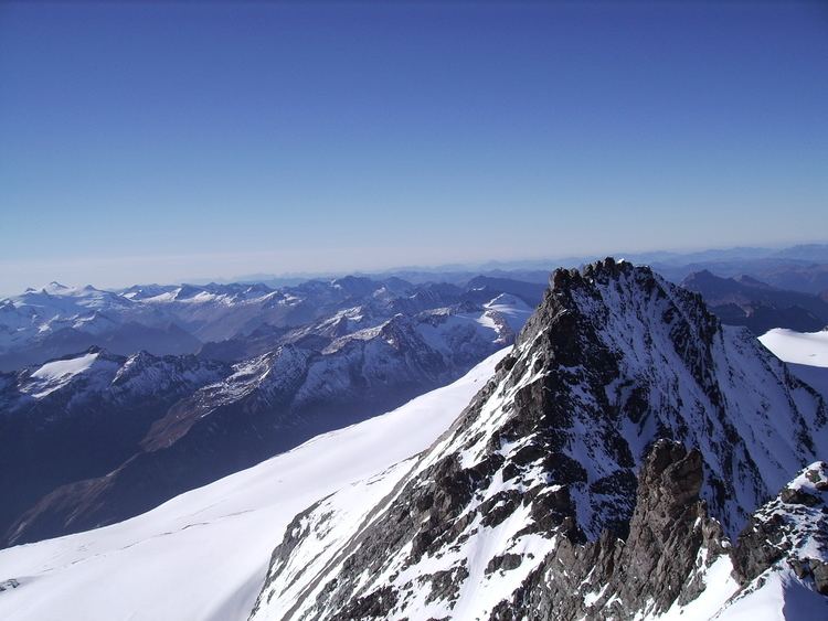
The Glocknerwand ( [ˈɡlɔknɐˌvant]) is a mountain in the Glockner Group in the Austrian Central Alps in the central region of the High Tauern. According to the literature it is 3,721 metres high, but the Austria Federal Office for Metrology and Survey gives its height as 3,722 metres. It is separated from Austria's highest peak, the neighbouring Großglockner, by the col known as the Untere Glocknerscharte (3596 m). The mountain lies on the boundary between East Tyrol and Carinthia.
Map of Glocknerwand, 9844, Austria
The Glocknerwand is a massive, fan-shaped mountain, that has very steep, over 400 metre high rock faces to the southwest and northeast. The summit region is covered with thick snowdrifts, that make its ascent dangerous and unpredictable. The towers of the Glocknerwand are therefore considered the most difficult summits to climb in the entire Glockner Group.