
Intercommunality Saint-Hippolyte Local time Wednesday 12:03 PM | Canton Saint-Hippolyte Area 15.93 km² Population 208 (1999) | |
 | ||
Region Bourgogne-Franche-Comté Weather 13°C, Wind NE at 13 km/h, 56% Humidity | ||
Glère is a commune in the Doubs department in the Bourgogne-Franche-Comté Region in eastern France.
Contents
Map of 25190 Gl%C3%A8re, France
Geography
Many of the residents work in the agricultural sector, with dairy farming still forming a large part of the local economy. A number of residents also commute to work in factories in nearby Switzerland.
Sights
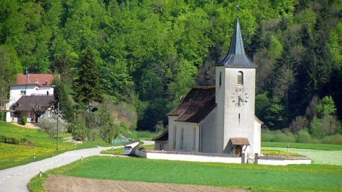
Glère hosts a 17th-century church, a post office, two restaurants, and a bar. The village, with its location on the tranquil Doubs River, is a perennial favorite with fishermen and campers.
In the early 1990s, Roger Macabrey, a recipient of the croix de guerre for his actions during World War II and a former mayor of Glère, served on the general council of Doubs department, where he promoted initiatives to attract more tourists to the region.
References
Glère Wikipedia(Text) CC BY-SA