
Country Albania Established 2000 Time zone CET (UTC+1) Area 2,884 km² Municipalities 7 | Villages 268 NUTS Code AL033 Population 70,331 (2016) University Eqrem Çabej University | |
 | ||
Points of interest Gjirokastër Fortress, Gjirokastër Ethnographic Museum, Arms Museum, Skenduli House, Çerçiz Topulli Square | ||
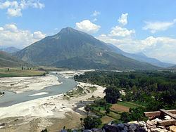
Gjirokastër County (Albanian: Qarku i Gjirokastrës) is one of the 12 counties of Albania. The population at the 2011 census was 72,176, in an area of 2884 km². Its capital is the city Gjirokastër.
Contents
Map of Gjirokast%C3%ABr, Albania
Administrative divisions
Until 2000, Gjirokastër County was subdivided into three districts: Gjirokastër, Përmet, and Tepelenë. Since the 2015 local government reform, the county consists of the following 7 municipalities: Dropull, Gjirokastër, Këlcyrë, Libohovë, Memaliaj, Përmet and Tepelenë. Before 2015, it consisted of the following 32 municipalities:
The municipalities consist of about 270 towns and villages in total. See Villages of Gjirokastër County for a structured list.
Demographics
Its population includes a substantial Greek minority. According to the last national census from 2011 this county has 72,176 inhabitants. Ethnic groups in the county include Albanians, Greeks, Montenegrins, Aromanians, Romani, Egyptians