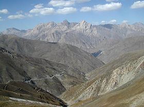
Elevation 4,643 m (15,233 ft) Country Tajikistan Mountains Khazret Sultan | Highest point Khazret Sultan Parent range Pamir Mountains | |
 | ||
Peak Khazret Sultan (former Peak of the 22nd Congress of the Communist Party) Similar Pamir Mountains, Fann Mountains, Iskanderkul, Köýtendag Range, Fedchenko Glacier | ||
Gissar Range (Russian: Гиссарский хребет, also known as Hissar or Hisor Range) is a mountain range in Central Asia, in the western part of the Pamir-Alay system, stretching over 200 km in the general east-west direction across the territory of Tajikistan and Uzbekistan.
Contents
Map of Gissar Range, Tajikistan
Geography
The Gissar Range lies south of the Zeravshan Range, extending north of Dushanbe through Tajikistan's Gissar District of the Districts of Republican Subordination and reaching Uzbekistan at the north tip of Surkhandarya Province. The highest point in the Gissar Range at 4,643 meters (15,233 ft) is located in Uzbekistan on the border with Tajikistan, just north-west of Dushanbe. Formerly known as Peak of the 22nd Congress of the Communist Party, the Khazret Sultan is also the highest point in all Uzbekistan. The Gissar Range is composed of crystalline rocks, schist, and sandstone, punctured by granite intrusions.
Hissar (Gissar) Valley, which encompasses the Shirkent National Park is a 3,000 hectares (7,400 acres) reserve, which is expected to be expanded to some 30,000 hectares (74,000 acres) in the coming years, has an unusually high concentration of sites of historical and scientific interest.
