
 | ||
Similar Ismoil Somoni Peak, Sarez Lake, Trans‑Alay Range, Independence Peak, Peak Korzhenevskaya | ||
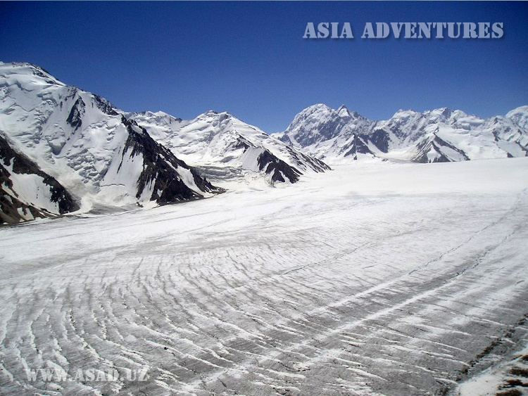
The Fedchenko Glacier (Russian Федченко) is a large glacier in the Yazgulem Range, Pamir Mountains, of north-central Gorno-Badakhshan province, Tajikistan. The glacier is long and narrow, currently extending for 77 kilometres (48 mi) and covering over 700 square kilometres (270 sq mi). It is the longest glacier in the world outside of the polar regions. The maximum thickness of the glacier is 1,000 metres (3,300 ft), and the volume of the Fedchenko and its dozens of tributaries is estimated at 144 cubic kilometres (35 cu mi)—about a third the volume of Lake Erie.
Contents
Map of Fedchenko Glacier, Tajikistan
Path and location
The glacier follows a generally northward path to the east of the 6,595 m (21,637 ft) Garmo Peak. The glacier begins at an elevation of 6,200 metres (20,300 ft) above sea level, and eventually melts and empties into the Balandkiik River near the border with Kyrgyzstan at an elevation of 2,909 metres (9,544 ft). Its waters eventually feed down the Muksu, Surkhob, Vakhsh, and Amu Darya rivers into the Aral Sea.
To the west is the Academy of Sciences Range, Mount Garmo, Ismoil Somoni Peak, Peak Korzhenevskaya and the headwaters of the Vanj River and Yazgulyam River. To the south is Independence Peak and to the east Gorbunov Peak (6,025 meters). To the north is Altyn Mazar.
Discovery
The glacier was discovered in 1878 but not fully explored until 1928 by a German-Soviet expedition under Willi Rickmer Rickmers. It is named after Alexei Pavlovich Fedchenko, a Russian explorer (but not discoverer of the glacier). In 1910-1913 the glacier expanded and moved forward by 800–1000 m, blocking up the Balyandlik River the following year. It continued to recede between 1928-1960, stopping its inflows such as the Kosinenko, Ulugbeck, Alert and several others.