
Founded 1845 Population 8,672 (2013) | Area 880.6 km² County seat Glenville University Glenville State College | |
 | ||
Website www.gilmercounty.wv.gov Rivers Little Kanawha River, Leading Creek, Indian Fork | ||
Gilmer County is a county in the U.S. state of West Virginia. As of the 2010 census, the population was 8,693. Its county seat is Glenville. The county was formed in 1845 from parts of Lewis and Kanawha Counties, and named for Thomas Walker Gilmer, Governor of Virginia from 1840 to 1841. Gilmer was later a representative in the United States Congress and Secretary of the Navy in President John Tyler's cabinet.
Contents
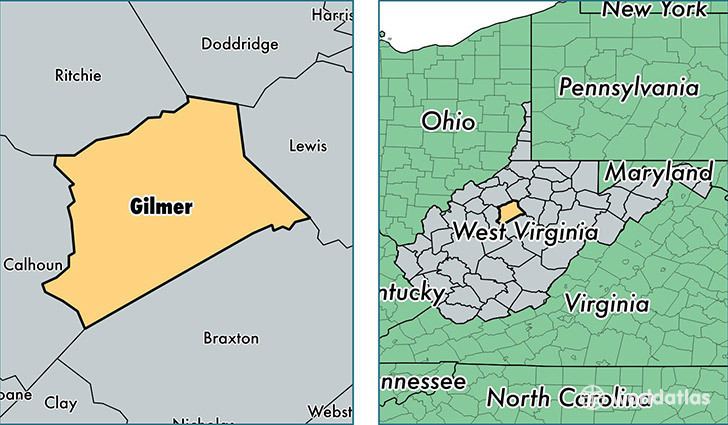
- Map of Gilmer County WV USA
- Geography
- Major highways
- Adjacent counties
- 2000 census
- 2010 census
- Towns
- References
Map of Gilmer County, WV, USA
Cedar Creek State Park offers camping, hunting, fishing and hiking. The West Virginia State Folk Festival is held each June. Glenville State College has a community activity center, a state-of-the-art library, and a complete collection of hand-carved, West Virginia–native birds on public display. The Gilmer County Recreation Center Complex includes a small golf course, a convention / reunion hall, and bunk houses. Gilmer County is home to ten nationally registered historic landmarks, the Cedar Creek Backway, and the annual West Virginia Folk Festival. Media outlets for the community include The Glenville Democrat and The Glenville Pathfinder, the county's two newspapers, and Two-Lane Livin', a regional magazine.
Gilmer County is also the site of Federal Correctional Institution, Gilmer, a federal medium security prison for men and the county's largest employer.
As of 2017, Gilmer County has one traffic light. It is in the city of Glenville.
Geography
According to the U.S. Census Bureau, the county has a total area of 340 square miles (880 km2), of which 339 square miles (880 km2) is land and 1.6 square miles (4.1 km2) (0.5%) is water.
Major highways
Adjacent counties
2000 census
As of the census of 2000, there were 7,160 people, 2,768 households, and 1,862 families residing in the county. The population density was 21 people per square mile (8/km²). There were 3,621 housing units at an average density of 11 per square mile (4/km²). The racial makeup of the county was 97.33% White, 0.91% Black or African American, 0.20% Native American, 0.57% Asian, 0.01% Pacific Islander, 0.10% from other races, and 0.88% from two or more races. 0.70% of the population were Hispanic or Latino of any race.
There were 2,768 households out of which 28.20% had children under the age of 18 living with them, 54.40% were married couples living together, 8.60% had a female householder with no husband present, and 32.70% were non-families. 25.50% of all households were made up of individuals and 12.30% had someone living alone who was 65 years of age or older. The average household size was 2.43 and the average family size was 2.92.
In the county, the population was spread out with 20.30% under the age of 18, 16.40% from 18 to 24, 24.50% from 25 to 44, 23.50% from 45 to 64, and 15.30% who were 65 years of age or older. The median age was 37 years. For every 100 females there were 101.10 males. For every 100 females age 18 and over, there were 101.40 males.
The median income for a household in the county was $22,857, and the median income for a family was $28,685. Males had a median income of $25,497 versus $15,353 for females. The per capita income for the county was $12,498. About 20.20% of families and 25.90% of the population were below the poverty line, including 27.70% of those under age 18 and 8.90% of those age 65 or over.
2010 census
As of the 2010 United States Census, there were 8,693 people, 2,753 households, and 1,806 families residing in the county. The population density was 25.7 inhabitants per square mile (9.9/km2). There were 3,448 housing units at an average density of 10.2 per square mile (3.9/km2). The racial makeup of the county was 82.5% white, 12.3% black or African American, 0.5% American Indian, 0.4% Asian, 0.1% Pacific islander, 2.4% from other races, and 1.7% from two or more races. Those of Hispanic or Latino origin made up 5.7% of the population. In terms of ancestry, 23.1% were German, 14.9% were Irish, 9.6% were American, and 6.1% were English.
Of the 2,753 households, 25.9% had children under the age of 18 living with them, 49.8% were married couples living together, 10.1% had a female householder with no husband present, 34.4% were non-families, and 27.6% of all households were made up of individuals. The average household size was 2.34 and the average family size was 2.83. The median age was 38.0 years.
The median income for a household in the county was $29,706 and the median income for a family was $38,044. Males had a median income of $30,654 versus $16,834 for females. The per capita income for the county was $13,899. About 25.1% of families and 30.3% of the population were below the poverty line, including 39.4% of those under age 18 and 13.1% of those age 65 or over.