
Population 11,756 Civil parish Gillingham Dialling code 01747 | OS grid reference ST805265 Sovereign state United Kingdom Local time Tuesday 12:54 AM | |
 | ||
Weather 8°C, Wind W at 11 km/h, 94% Humidity | ||
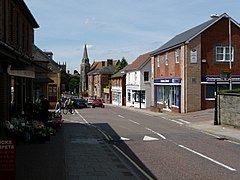
Gillingham /ˈɡɪlɪŋəm/ is a town and civil parish in the Blackmore Vale area of Dorset, England. It lies on the B3095 and B3081 roads in the North Dorset administrative district, approximately 4 miles (6.4 km) south of the A303 trunk road and 5 miles (8.0 km) northwest of Shaftesbury. It is the most northerly town in the county. In the 2011 census the civil parish had a population of 11,756. The neighbouring hamlets of Peacemarsh, Bay and Wyke have become part of Gillingham as it has expanded.
Contents
Map of Gillingham, UK
Gillingham is pronounced with a hard initial 'G' as in 'Goat', unlike Gillingham, Kent, which is pronounced with a soft 'G' as in 'Germany'.
History
There is a stone age barrow in the town, and evidence of Roman settlement in the 2nd and 3rd centuries; however the town was established by the Saxons. The church of St Mary the Virgin has a Saxon cross shaft dating from the 9th century.
The name Gillingham was used for the town in its 10th century Saxon charter, and also in an entry for 1016 in the annals, as the location of a battle between Edmund Ironside and the Vikings. In the Domesday Book in 1086 it is recorded as Gelingeham, and later spellings include Gellingeham in 1130, Gyllingeham in 1152 and Gilingeham in 1209. The name derives from a personal name plus the Old English inga and hām, and means a homestead of the family or followers of a man called Gylla.
Half of the town's population of 2,000 died of the Black Death in the four months following October 1348.
In the Middle Ages, Gillingham was the site of a royal hunting lodge, visited by Kings Henry I, Henry II, John and Henry III. A nearby royal forest was set aside for the king's deer. The lodge fell into disrepair and was destroyed in 1369 by Edward III.
Edward Rawson, the first secretary to the Massachusetts Bay Colony, was born in Gillingham.
Gillingham became a local farming centre, gained the first grammar school in Dorset in 1516 and a mill for silk in 1769. Gillingham's church has a 14th-century chancel, though most of the rest of the building was built in the 19th and 20th centuries. Many other buildings in the town are of Tudor origin.
In the 1820s, the artist John Constable stayed at Gillingham vicarage and, being impressed by the beauty of the countryside, executed several local sketches and paintings. His painting of the old town bridge is in the Tate Gallery. In the 1850s, the arrival of the railway to the town brought prosperity and new industries including brickmaking, cheese production, printing, soap manufacture and at the end of the 19th century one of the first petrol engine plants in the country. In the Second World War Gillingham's position on the railway from London to Exeter was key to its rapid growth. In 1940 and 1941 there was large-scale evacuation of London and other industrial cities to rural towns, particularly in the north, southwest and Wales. Gillingham grew rapidly because of this. Gillingham was the centre of a Liberty of the same name.
Demography
In the 2011 census Gillingham civil parish had 5,345 dwellings, 5,107 households and a population of 11,756.
The population of the parish in the censuses between 1921 and 2011 is shown in the table below:
Governance
Gillingham is divided into four electoral wards: Gillingham Town, Lodbourne, Milton and Wyke. Their total population in the 2011 census was 9,799. They form part of the constituency of North Dorset, which is currently represented in the UK parliament by the Conservative Simon Hoare.
Economy and society
Gillingham has good transport links, being 4 miles south of the A303, the main road from London to the South West, and having a railway station on the Exeter to London railway line. Salisbury is about 30 minutes away by train, and 50 minutes by car. It is approximately two hours into central London, with trains arriving at Waterloo.
The town has 70 shops and two commercial estates (Brickfields Business Park and Brickfields Industrial Estate) and the Gillingham education area has 7 primary schools (4 in the town) and 1 secondary school.
The town plays host to the annual 'Gillingham & Shaftesbury Show', which is an agricultural show held every August at the showground on the outskirts of the town. Gillingham Town Carnival is held every October.
Gillingham has a Non-League football club, Gillingham Town F.C., who play at Harding's Lane, and a rugby union club. Until 2009, when it ceased for financial reasons, Gillingham hosted an annual 10-day festival of music and sport. Gillingham has had a brass band since 1928; they are currently nationally graded in the 3rd Section, and perform at civic events and carnivals. Gillingham has the only night club in North Dorset.