
Elevation 855 m | ||
 | ||
Traversed by NC 226 / NC 226ABlue Ridge Parkway Location North CarolinaUnited States Similar Blue Ridge Mountains, Museum Of North Carolina, N & W Railroad Overlook, Devils Backbone Overlook, Chestoa View Parking A | ||
Up gillespie gap 3gp
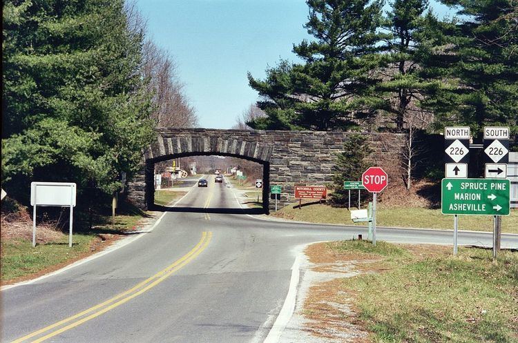
Gillespie Gap (el. 2,805 ft (855 m)), also known as Etchoe Pass, is a mountain pass along the Blue Ridge Mountains. Historically, two event occurred at the pass. The first was in 1761 when thirty men, under the command of Francis Marion, were sent to dislodge an encampment of Cherokee warriors at the pass; ambushed, Marion lost twenty-one men. The second was in 1780 when the Overmountain Men crossed the pass on their way to Kings Mountain.
Contents
Map of Gillespie Gap, Grassy Creek, NC 28777, USA
NC 226 traverses through the gap, which connects Marion and Spruce Pine. Intersecting at the gap is NC 226A, which goes to nearby Little Switzerland. The Blue Ridge Parkway also passes through the gap, providing scenic views along the adjacent ridge lines. The gap is also along the Eastern Continental Divide and the McDowell–Mitchell county line.