
Country United States | State Pennsylvania | |
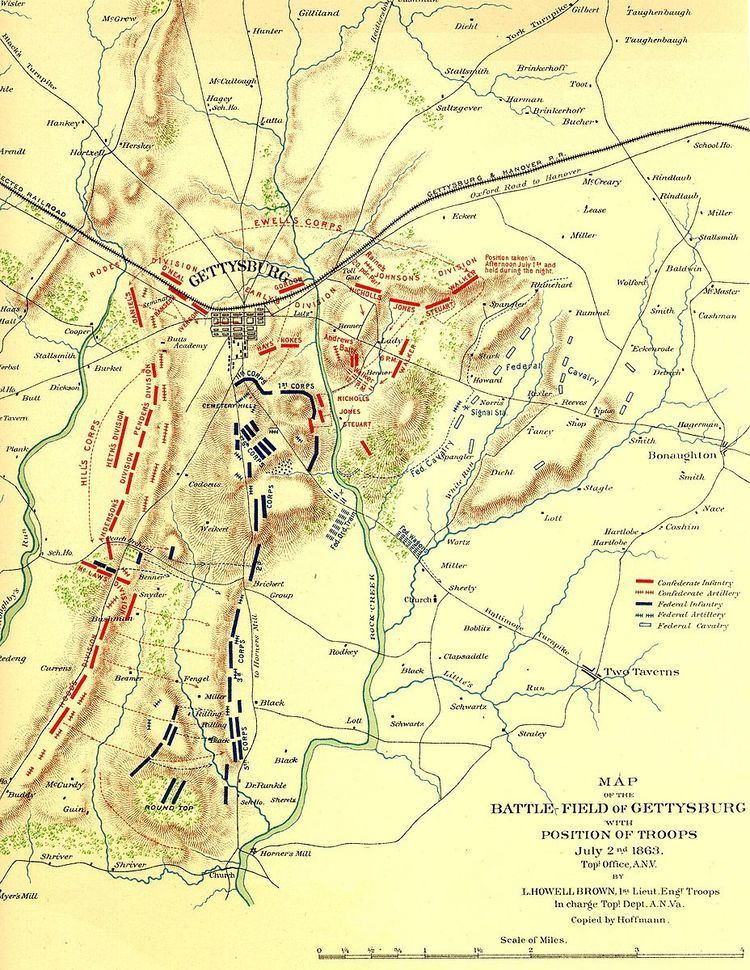 | ||
Etymology Gettys Tavern & Black's Mill Location northern point (confluence of Stevens Cr/Rock Cr) | ||
The Gettys-Black divide is the primary drainage divide of Cumberland Township, Adams County, Pennsylvania; extending from the mouth of Stevens Creek southward past Samuel Gettys' 1761 tavern ~7 miles to the mouth of Plum Run at the dam site for Robert Black's 1798 Mill. From a ridge within the Gettysburg borough, the divide extends southward across several strategic features of the Gettysburg Battlefield:
The divide descends the east slope of Big Round Top and passes north of a drainage, then extends south-southeast across farm fields near the Taneytown Road to Rock Creek at the unincorporated community of Barlow, Pennsylvania.
References
Gettys-Black divide Wikipedia(Text) CC BY-SA