
Length 52 km | River mouth Save175 m (574 ft) Source Arné | |
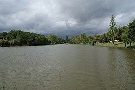 | ||
The Gesse (French: la Gesse) is a 52.1 km (32.4 mi) long river in the Hautes-Pyrénées, Haute-Garonne and Gers départements, southwestern France. Its source is at Arné, on the plateau de Lannemezan. It flows generally northeast. It is a left tributary of the Save into which it flows at Espaon.
Contents
- Map of La Gesse France
- Cd gesse duarte n o desista
- Dpartements and communes along its course
- References
Map of La Gesse, France
Cd gesse duarte n o desista
Départements and communes along its course
This list is ordered from source to mouth:
References
Gesse Wikipedia(Text) CC BY-SA