
Type Highway Length 333 km | Route number(s) State Route 123 | |
 | ||
Major settlements | ||
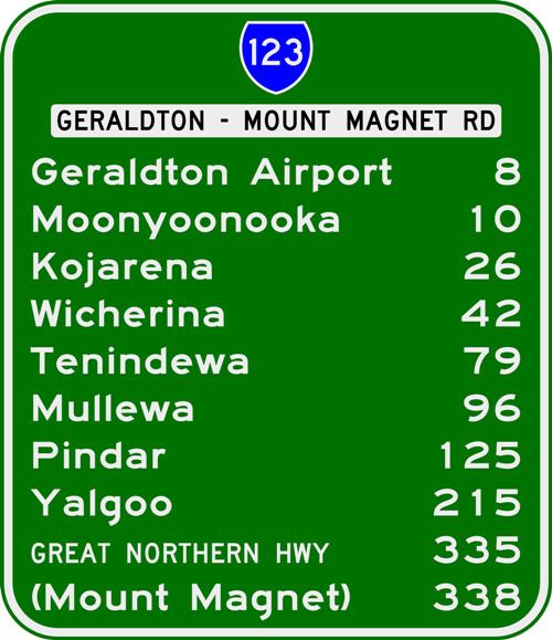
Geraldton–Mount Magnet Road is a 335-kilometre-long (208 mi) major regional road in the Mid West region of Western Australia, starting in Utakarra in Geraldton's eastern suburbs, and terminating 333 kilometres (207 mi) east-northeast at Great Northern Highway near the mining town of Mount Magnet. The road is signed as State Route 123, is a two-lane single carriageway for its entire length, and is a major traffic route which is regularly used by heavy vehicles and mine/grain road trains.
Contents
Map of Geraldton-Mount Magnet Rd, Western Australia, Australia
The construction of Stage Two of the Geraldton Southern Transport Corridor is expected to remove considerable traffic from the Geraldton end of the road.
Description
Geraldton–Mount Magnet Road commences in Utakarra as a continuation of Utakarra Road, which carries State Route 123 from North West Coastal Highway 1.8 kilometres (1.1 mi) to the southwest. It heads east towards Geraldton Airport, then east-northeast through the flat-topped Moresby Ranges on its way towards the agricultural town of Mullewa. It then travels in a generally straight line through Yalgoo and ends at the Great Northern Highway 3 km south of Mount Magnet.
Towns
Towns and settlements on this highway include: