
- average 22 m/s (777 cu ft/s) Basin area 232,000 km² Length 1,130 km Source Barkly Tableland | - min 0 m/s (0 cu ft/s) Discharge 22 m³/s Basin area 232,000 km² | |
 | ||
- max 200 m/s (7,063 cu ft/s) | ||
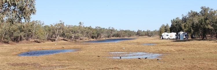
Video 323 donohue highway pituri creek to basin waterhole georgina river
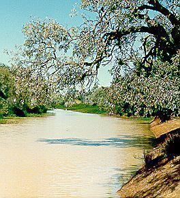
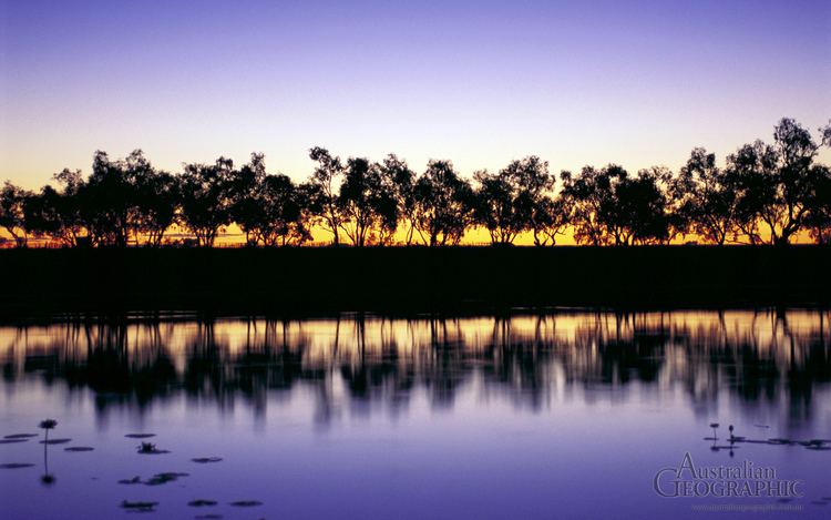
The Georgina River is the north-westernmost of the three major rivers of the Channel Country in Central West Queensland that flow in extremely wet years into Lake Eyre. It was originally called the Herbert River before being given its current name in 1890 to avoid confusion with the other river in Queensland that bore (and still bears) that name. The newer name commemorates Georgina Mildred Kennedy, Queensland governor Arthur Kennedy's daughter.
Contents
- Video 323 donohue highway pituri creek to basin waterhole georgina river
- Video 324 donohue highway basin waterhole georgina river to herbert downs st t o
- Geography
- Climate
- Flooding
- References
Video 324 donohue highway basin waterhole georgina river to herbert downs st t o
Geography
The river rises from several smaller streams over a wide area of north-western Queensland and the eastern Northern Territory. These include the Burke River, flowing through the basin's major town of Boulia, the upper Georgina River itself rising in the Barkly Tableland north of Camooweal, the Ranken River rising in the extreme east of the Northern Territory beyond Tennant Creek, and the Sandover River. The Sandover, unlike all other tributaries of Lake Eyre, flows northwards from the Macdonnell Ranges in very wet years to enter the Georgina near Urandangi.
The basin of the Georgina totals around 232,000 square kilometres (90,000 sq mi), or about the same size as the Australia state of Victoria. Because it is so arid, however, its mean annual flow is only about 0.7 km3 (570,000 acre·ft). There is such extreme variation that – although streamgauging records are too poor to prove it conclusively – meteorological records leave no doubt that there have been many years of zero runoff' in the entire basin (1905, 1928 and 1961 would without doubt fit into this category), whilst in very wet years such as 1974, 1977 and 2000, runoff can be as high as 6.28 km3 (5,090,000 acre·ft) or more.
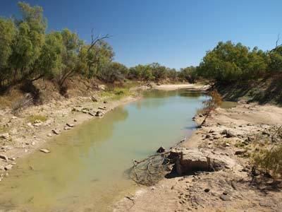
Although a small part of the rugged Macdonnell Ranges drains into the Georgina, most of the catchment is a flat as the Diamantina, though low ranges are very prominent in the north-west of the basin. This western part of the basin has soils that are too infertile to provide nutritious fodder for cattle or sheep and a large proportion is an Aboriginal reserve. The eastern part of the Georgina catchment near Boulia is very similar to the Diamantina and Cooper basins, being grassy plains with heavy cracking clay soils that are quite fertile and provide very good feed in wet years for livestock. The Lake Machattie Area is an important breeding site for waterbirds.
Climate
Climatically, the Georgina catchment tends to be somewhat drier than the Diamantina or Cooper, with average annual rainfall ranging from around 400 millimetres (16 in) north of Camooweal to around 225 millimetres (8.9 in) at Bedourie.
Extremely dry years can give the entire basin less than 100 millimetres (3.9 in) whilst in 1974, 1977 and 2000 many areas had over 800 millimetres (31 in) and some as much as 1,000 millimetres (39 in). Almost all of this rain falls in the summer, and it is quite normal for the period from May to September to not record any measurable falls at all. In extremely wet summer months such as January 1974 or March 1950, most of the catchment can receive as much as 350 millimetres (14 in) in a month or 150 millimetres (5.9 in) in a day or two. Temperatures are generally hot, with most areas having maxima of over 30 °C (86 °F) on over 225 days per year. Frosts are rare but have been reported on occasions in all areas of the basin – however even in June and July maxima are around 25 °C (77 °F).
Flooding
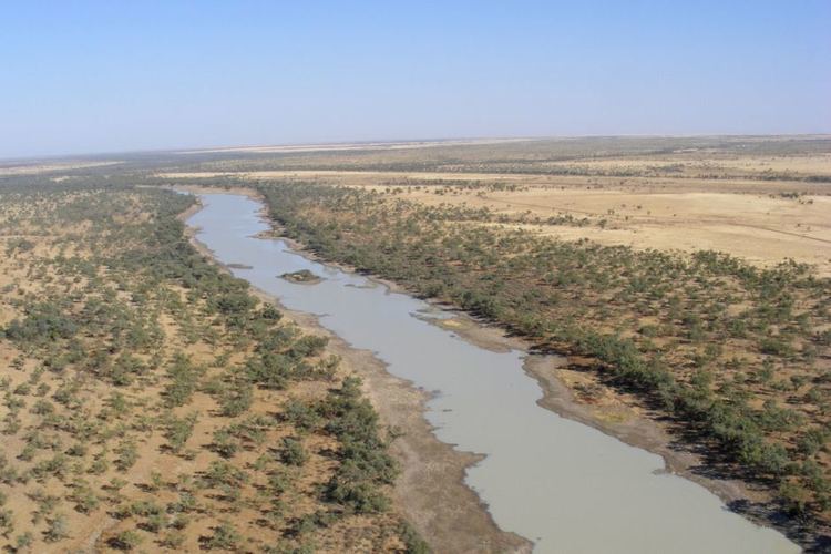
During severe floods the river can be as wide as 15 to 20 km in the upper reaches and in the lower reaches from 25 to 30 km wide. Inundation can last for months at a time, which can disrupt road and rail transport in the area. The highest recorded flood occurred in January 1974.
Flooding occurred at Glenormiston Station in 1885 when somewhere between 12 inches (305 mm) and 17 inches (432 mm) of rain fell over the course of a month. The Georgina River and the Diamatina Rivers both were flooded and the Sandringham station was submerged.
The upper watershed in the Northern Territory were subjected to severe flooding in 1901 when Lake Nash Station experienced over 10 inches (254 mm) of rain in a single day, with the Georgina River running at almost record high levels. The surrounding areas received over 4 inches (102 mm) of rain in 1953 resulting in the River rising over 23 feet (7 m), the highest level in over 36 years.
The lower reaches flooded in 1950 and again in 1953 following heavy rain events further north. The 1953 flood was 6 inches (152 mm) higher at Glengyle Station compared to the 1950 event. The Diamantina River was also in flood and the waters were expected to make it to Lake Eyre.
Moderate flooding was experienced along the river, including Glenormiston Station, in 2010 following heavy rains locally and further north in the Georgina catchment.
Although it is the driest of the three main rivers of the Lake Eyre Basin, there is evidence that the Georgina has, in the past, actually reached the lake more frequently than either the Diamantina or Cooper. Some wave built shingle terraces suggest that during the Medieval Warm Period Lake Eyre held permanent water. Large increases since the late 1960s in rainfall over the Northern Territory and pastoral areas of South and Western Australia that have not been duplicated over Queensland do suggest an enhanced greenhouse effect in the Medieval Warm Period may have caused the Georgina to regularly fill Lake Eyre. However, far too little evidence exists for any certainty of this.