
Population 187 (2011 census) Postcode(s) 4828 Founded 1884 Local time Tuesday 9:21 PM | Established 1884 Elevation 231 m Postal code 4828 | |
 | ||
Location 1,731 km (1,076 mi) NW of Brisbane1,135 km (705 mi) SE of Darwin169 km (105 mi) NW of Mount Isa412 km (256 mi) E of Tennant Creek Weather 27°C, Wind NE at 11 km/h, 82% Humidity | ||
Camooweal slim dusty
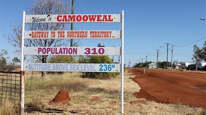
Camooweal is a small town and locality in the City of Mount Isa, Queensland, Australia. At the 2011 census, Camooweal had a population of 187.
Contents
- Camooweal slim dusty
- Map of Camooweal QLD 4828 Australia
- Slim dusty camooweal wmv
- Geography
- History
- Heritage listings
- Amenities
- References
Map of Camooweal QLD 4828, Australia
Slim dusty camooweal wmv
Geography
Camooweal is in north-western Queensland, Australia, located 169 kilometres (105 mi) north-west of the city of Mount Isa and 12 km (7.5 mi) east of the Northern Territory border. The town lies on the Barkly Highway, and is adjacent to the Georgina River.
History
The area was originally inhabited by the Indjilandji Indigenous Australians. The town is said to take its name from surveyor Mr GT Weale, who was apparently the first person to bring camels into the area, although this has been questioned.
William Landsborough in 1861 named the Barkly Tablelands after the Governor of Victoria, His Excellency, Sir Henry Barkly. The first settler to the area was John Sutherland, who took up the Rocklands lease in 1865. Stock losses to the local dingos and wedge-tailed eagles; lack of water and isolation soon forced him to abandon his lease. The Englishmen Benjamin Crosthwaite and William Tetley, who were marginally more successful, took up the lease again in 1876.
The initial town was gazetted in 1884 to be built on a 4-square-mile (10 km2) plot by Lake Francis. A year later the present site was re-gazetted and Camooweal Post Office opened on 27 April 1885. Other milestones for the town were the addition of a police station in 1886, opening of a provisional school in 1893, drilling of the town bore in 1897 and the arrival of electricity in 1952.
On January 2nd, 1931, a Qantas Air Ambulance from the Royal Flying Doctor Service of Australia flown by E.G. Donaldson rescued a man in Camooweal and delivered him to Brisbane.
The road through Camooweal to the Northern Territory was the inland defence route for World War II. This road was built by army engineers and carried over 1000 vehicles a day and there are numerous historical sites marked along the road.
Heritage listings
Camooweal has a number of heritage-listed sites, including:
Amenities
Along the main road (the Barkly Highway) there are several caravan stops or van parks which will take mobile homes and tents. There is an airstrip that is used by the Royal Flying Doctor Service to bring medical services to the town.
Australian country musician Slim Dusty recorded a song written by David Kirkpatrick and Alex "Mack" Cormack entitled simply Camooweal which features this town.