
Length 130.4 km | ||
 | ||
North end: US 41 / SR 7 north of Wenona | ||
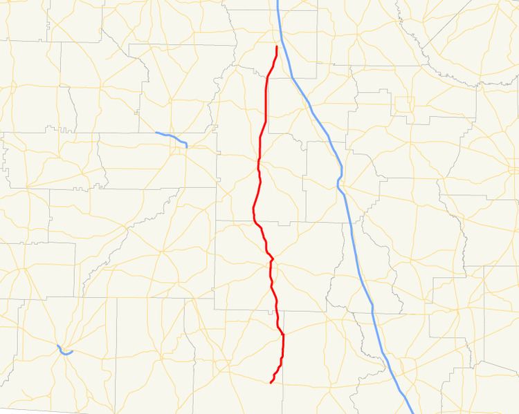
State Route 33 (SR 33) is an 81-mile-long (130 km) state highway that travels south-to-north through portions of Thomas, Brooks, Colquitt, Worth, and Crisp counties in the south-central part of the U.S. state of Georgia. The highway travels from its southern terminus, an intersection with US 84/SR 38 in Boston, to its northern terminus, an intersection with US 41/SR 7 north of Wenona. It also travels through Moultrie and Sylvester.
Contents
Map of GA-33, Georgia, USA
Route description
SR 33 begins at an intersection with US 84/SR 38 in Boston. The highway travels north-northeast to Pavo. After a brief concurrency in Pavo with SR 122, SR 33 travels to the north-northwest. In the southern part of Moultrie, SR 33 begins a concurrency with US 319 Bus. on Thomasville Road. The two highways travel north, through downtown Moultrie. North of the city, US 319 Bus. ends, and, after a brief concurrency with SR 133, SR 33 continues north to Sylvester. In Sylvester, SR 33 has a brief concurrency with SR 112 before departing and continuing north to meet its northern terminus, an intersection with US 41/SR 7 just north of Wenona, which is south of Cordele.
Bannered route
State Route 33 Connector (SR 33 Conn.) is a 1.8-mile-long (2.9 km) connector route near Cordele. SR 33 Conn. connects the SR 33 mainline, as well as US 41/SR 7, with Interstate 75 (I-75), via Rockhouse Road.
The entire route is in Crisp County.