
Existed: 1938 – present Constructed 1938 | Length 41.4 km | |
 | ||
Majorjunctions: SR 104 in Augusta I‑20 in Augusta US 1 / US 25 / US 78 / US 278 / US 25 Bus. / SR 10 / SR 121 in Augusta I‑520 in Augusta Counties | ||
State Route 28 (SR 28) is a 25.7-mile-long (41.4 km) state highway in the U.S. state of Georgia. It exists in two distinct segments separated by the northern segment of South Carolina Highway 28 (SC 28), which connects the two segments. The northern segment is located in the northeastern corner of the Chattooga River District of the Chattahoochee-Oconee National Forest. The southern segment is entirely within the Augusta metropolitan area. SR 28 consists of Georgia's segments of a multi-state Route 28 that includes one segment of North Carolina Highway 28 (NC 28) and two segments of SC 28. The northern segment of SR 28 is unnamed, but the southern segment is known as Furys Ferry Road from its western terminus to the intersection with SR 104 Conn. in Augusta. It is known as Washington Road in the northern part of Augusta. It is known as John C. Calhoun Expressway, Greene Street, 5th Street, and Broad Street in downtown Augusta. It is known as Sand Bar Ferry Road in the northeastern part of Augusta.
Contents
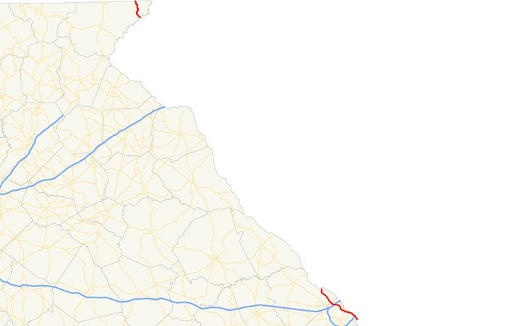
Map of GA-28, Georgia, USA
Northern segment
The northern segment of SR 28 is a 7.9-mile-long (12.7 km) highway. It begins at the North Carolina state line, where the roadway continues as North Carolina Highway 28 (NC 28). The highway is a twisting route that is completely within the Chattooga River District of the Chattahoochee-Oconee National Forest in Rabun County. There are only two settlements on the highway, Satolah and Pine Mountain. It crosses over the Chattooga River on the Russell Bridge into South Carolina, where it continues as the northern segment of South Carolina Highway 28 (SC 28).
Southern segment
SR 28 resumes where SC 28 meets the state line on the Furys Ferry Bridge, northwest of Martinez. It travels through rural areas of Columbia County and passes Jones Creek Golf Course before entering Martinez. In town, SR 28 passes by West Lake Country Club and continues to the southeast. After that, it enters Richmond County and the city limits of Augusta. Approximately 1,000 feet (300 m) after an intersection with SR 104 (Riverwatch Parkway) is an intersection with the eastern terminus of SR 104 Conn. (Washington Road). Here, SR 28 takes on the Washington Road name. Just under 1 mile (1.6 km) later, is an interchange with Interstate 20 (I-20; Carl Sanders Highway). Then, it curves to the east-southeast. It skirts along the northeastern part of Augusta National Golf Club, where the Masters Tournament is held every spring. After that, SR 28 curves to the south-southeast. At a partial interchange with Broad Street, the Washington Road name ends and the John C. Calhoun Expressway designation begins. The expressway skirts along the southwestern and southern edges of Lake Olmstead. It travels under Milledge Road and has an interchange with Eve Street and Crawford Avenue. A few hundred feet later, it has a partial interchange with 15th Street. The roadway then travels over St. Sebastian Way. After crossing over the Augusta Canal and SR 4 (13th Street), the expressway ends and SR 28 becomes known as Greene Street. It turns left onto 5th Street and then meets US 25 Bus. and the eastern terminus of SR 104 (Broad Street).US 25 Bus./SR 28 travel to the southeast on Broad Street. At an interchange with US 1/US 25/US 78/US 278/SR 10/SR 121 (Gordon Highway), US 25 Bus. ends, and SR 28 continues through the Olde Town section of the city. During a slight southerly jog, the local street name transitions to Sand Bar Ferry Road. SR 28 travels to the southeast and has an interchange with I-520 (Bobby Jones Expressway) and Laney-Walker Boulevard. It curves to the south-southeast and intersects the eastern terminus of Laney–Walker Boulevard Extension; then, the road curves to the east and again meets the South Carolina state line, where the road crosses over the Savannah River on the Sand Bar Ferry Bridge and continues, again as the southern segment of SC 28, and retains the Sand Bar Ferry Road name. All of SR 28, from the intersection with SR 104 Conn. to the eastern terminus of the southern segment, is included as part of the National Highway System, a system of roadways important to the nation's economy, defense, and mobility.
History
The road that would eventually become SR 28 was established at least as early as 1920 between the North Carolina and South Carolina state lines. By 1921, the highway was signed as SR 65 on the entire northern segment and as SR 52 on the entire southern segment. Before 1926 ended, the entire length of SR 52 had a "sand clay or top soil" surface. By the middle of 1930, in an area northwest of Augusta, SR 52 was shifted to a more western alignment. This segment was located about half of the distance from the Columbia–Richmond county line and the original segment. The original part northwest of the split did not have a highway number. The highway had a "completed hard surface" from there to Augusta. The year ended with all of SR 52 having a "completed hard surface". The original part's Richmond County portion did, too. By February 1932, the entire length of both parts had a completed hard surface. Near the end of the year, all of SR 65 was redesignated as SR 105. The northwestern part of the southern segment was re-signed as SR 52. The western extended part was re-designated as SR 104. By the end of 1934, the entire length of SR 105 was under construction. By the middle of 1937, SR 105 had a completed grading, but was not surfaced. Before 1938, all of SR 105 and SR 52 were redesignated as SR 28. By the end of 1939, the northern segment had a completed hard surface.