
Length 55.2 km | ||
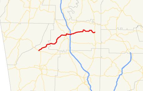 | ||
State Route 156 (SR 156) is a 34.3-mile-long (55.2 km) state highway that runs west-to-east through portions of Floyd and Gordon counties in the northwestern part of the U.S. state of Georgia.
Contents
Map of GA-156, Georgia, USA
Route description
SR 156 begins at an intersection with US 27/SR 1 north of Rome, in Floyd County. It heads northeast through rural areas until it enters Gordon County. The highway continues to the northeast and curves to the east to Calhoun. The first intersection in Calhoun is SR 136 Connector (River Street). The two highways head concurrent to the north-northwest for about 700 feet (210 m). They split, with SR 156 heading to the northeast, and then to the southeast, over a CSX Transportation railroad, to an intersection with US 41/SR 3 (North Wall Street). SR 156 continues to the southeast and heads east to an interchange with Interstate 75 (I-75). The highway heads northeast and east to meet its eastern terminus, an intersection with US 411/SR 61 north of Ranger.
SR 156 is not part of the National Highway System, a system of roadways important to the nation's economy, defense, and mobility.