
Length 40.7 km | ||
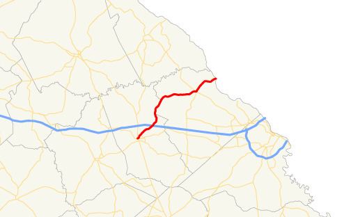 | ||
State Route 150 (SR 150) is a 25.3-mile-long (40.7 km) state highway that travels southwest–to–northeast through portions of McDuffie and Columbia counties in the east-central part of the U.S. state of Georgia. It travels from Thomson northeast to the South Carolina state line, southwest of Clarks Hill, South Carolina.
Contents
Map of GA-150, Georgia, USA
Route description
SR 150 begins at an intersection with SR 17 (Main Street) in Thomson. It heads northeast to an intersection with US 78/SR 10/SR 17 Bypass (Thomson Bypass), just before leaving town. Northeast of Thomson is an interchange with Interstate 20 (I-20; Carl Sanders Highway). Between I-20 and Pollards Corner, SR 150 travels along the McDuffie–Columbia county line. Then, it continues to the northeast to the Unincorporated community of Pollards Corner. There, SR 47/SR 150 travel concurrently for one block. At an intersection with U.S. Route 221 (US 221) and the western terminus of SR 104, SR 47 splits off to travel concurrently with US 221 south, while SR 150 splits off to travel concurrent with US 221 north. SR 150 follows US 221 until they reach the South Carolina state line, where US 221 crosses over the Clarks Hill Dam and continues northeast to Clarks Hill.
SR 150 is not part of the National Highway System, a system of routes determined to be the most important for the nation's economy, mobility and defense.