
Length 32.2 km | ||
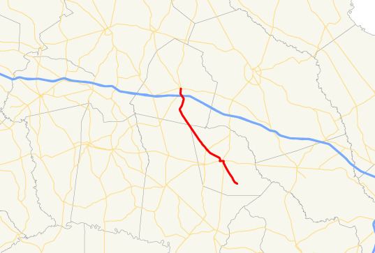 | ||
State Route 129 (SR 129) is a 20.0-mile-long (32.2 km) state highway that travels southeast-to-northwest through portions of Evans, Tattnall, and Candler counties in the east-central part of the U.S. state of Georgia. It connects the towns of Claxton and Metter.
Contents
Map of State Rte 129, Georgia, USA
Route description
SR 129 begins just northwest of Fort Stewart, in rural Evans County, at an intersection with Old Hwy. 250 (former SR 250) and John Todd Road. The highway then heads northwest to an intersection with US 280/SR 30 (West Main Street) in Claxton, still within Evans County. It heads northwest to meet SR 169 and SR 169 Spur, north-northeast of Bellville. The highway continues to the northwest, cuts across the extreme northeastern corner of Tattnall County, and enters Candler County. SR 129 continues to the northwest and then curves to the north-northeast for just over 2 miles (3.2 km), crossing over the Canoochee River along the way. After that, the highway heads northwest again for about 1 mile (1.6 km). During this stretch, it crosses over, but does not have an interchange with, Interstate 16 (Jim Gillis Historic Savannah Parkway). The roadway tuns northward into Metter. It continues to the north until it meets its northern terminus, an intersection with SR 46 (East Broad Street).
SR 129 is not part of the National Highway System, a system of roadways important to the nation's economy, defense, and mobility.