
Length 30.7 km | ||
 | ||
Counties | ||
State Route 10 Loop (SR 10 Loop, also known as Loop 10, Paul Broun, Sr. Parkway, or the Athens Perimeter) is a 19.1-mile-long (30.7 km) state highway in the form of a beltway around much of Athens in the U.S. state of Georgia built to freeway standards. Much of the road is concurrent with other routes (including U.S. Route 29, US 78, US 129, US 441, SR 8, and SR 15) that travel through the Athens area. It also carries the unsigned SR 422. Only US 78 Business, SR 10, and SR 15 Alternate travel through downtown Athens. Inner/outer directions are used to sign the loop.
Contents
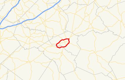
Map of GA-10 Loop, Athens, GA, USA
Between exits 4 and 8, there is an eight-highway concurrency, consisting of US 29/US 78/US 129/US 441/SR 8/SR 10 Loop/SR 15/SR 422 (counting the unsigned SR 422). This concurrency ties the American record of most highways in a single concurrency. The record holder is Interstate 74 (I-74), I-465, US 31, US 36, US 40, US 52, Indiana State Road 37 (SR 37), and SR 67 in the Indianapolis, Indiana metropolitan area.
Route description
SR 10 Loop begins at an interchange with US 29, US 78, SR 8 and SR 316 to the south, and Epps Bridge Parkway to the north in Oconee County south of Athens. It heads east as a four-lane freeway, concurrent with US 29, US 78, and SR 8, and crosses McNutt Creek to enter Clarke County and Athens as it meets a partial cloverleaf interchange with US 129, US 441 and SR 15, which includes a connection to Timothy Road to the north. Those three routes join SR 10 Loop as it continues east and crosses the Middle Oconee River. The freeway then curves to the northeast and intersects Milledge Avenue, where SR 15 Alternate begins, heading north from the interchange.
After this intersection, SR 10 Loop crosses a Georgia shortline railroad and turns to the northeast, where it meets College Station Road at a diamond interchange. At this point the highway right-of-way abuts the University of Georgia campus; immediately north of the College Station Road interchange is an on-ramp to a campus parking lot that is normally closed, but is used on home football game days to allow departing spectators access onto inner 10 Loop directly from campus. Northeast of here, the highway crosses the North Oconee River and meets a folded diamond interchange with SR 10, which is Oconee Street west of the interchange and Lexington Road east of it. At this interchange, US 78 splits from the highway and turns east, and its business route (US 78 Bus.) begins and heads west toward the center of the city.
North of this interchange, SR 10 Loop curves to the northwest and intersects with Peter Street and Olympic Drive at a partial cloverleaf interchange, then crosses Trail Creek. This intersection was the last on SR 10 Loop to be upgraded to a limited access interchange. Its completion in February 2015 completed the Athens beltway as a fully limited-access highway. North of here, the highway crosses a CSX railroad, then meets an interchange with Old Hull Road. This interchange does not provide complete access between the two roads; there is only an exit going northbound and only an entrance from Old Hull Road going southbound. Just north of here, the highway meets an interchange at which US 29 and SR 8 continue north while SR 10 Loop, US 129, US 441, and SR 15 exit and turn due west. This interchange also completes access to Old Hull Road by providing the movements missing from the aforementioned interchange: an exit from the inner loop and an entrance to the outer loop.
West of this interchange, the freeway passes over the western fork of Trail Creek, then meets a partial cloverleaf interchange with North Avenue and Danielsville Road. Farther west, it intersects Dr Martin Luther King Jr Parkway and Commerce Road at a diamond interchange. Here, US 441 and SR 15 leave the freeway and turn north along Commerce Road. SR 10 Loop then curves in a southwesterly direction and crosses the North Oconee River again before coming to another diamond interchange, this one with Chase Street.
SR 10 Loop continues southwest and crosses the CSX railroad again, then dips to the north and intersects SR 15 Alternate, which is Prince Avenue south of the interchange and Jefferson Road north of it. At this interchange, US 129 leaves SR 10 Loop and joins SR 15 Alternate heading north towards Jefferson. The freeway's next exit to the southwest is a diamond interchange with Tallassee Road and Oglethorpe Avenue. Farther southwest, SR 10 Loop crosses the Middle Oconee River again, then intersects SR 10 and US 78 Bus at a partial cloverleaf interchange with Atlanta Highway.
Then, SR 10 Loop curves back to the southeast, crosses McNutt's Creek, leaving Athens and crossing back into Oconee County. The freeway has one final exit with the Oconee Connector, access to which is incomplete; the outer loop has only an exit, and the inner loop has only an entrance. Finally, the highway curves back to the east and meets the interchange with US 29, US 78, SR 8, and SR 316, where the exit numbers reset and the loop begins again.
All of SR 10 Loop is included as part of the National Highway System, a system of roadways important to the nation's economy, defense, and mobility.
History
Various sections of the route were constructed and opened before other sections. The first section to open was the northern part, between US 129/Prince Avenue and Old Hull Road, although US 29 north of 10 Loop had not been built at that time. The next section was an extension of the first section, westward to Atlanta Highway, which was US 29 & 78 at the time (it is now US 78 Business). This was followed by the eastern part of the route, from US 29 to Milledge Avenue (US 29 north of 10 Loop opened at the same time). The final part of the route to be constructed was the southern section from Milledge Avenue to Atlanta Highway.
New exit numbers were assigned on August 2, 2004.
In 2005, new Georgia Department of Transportation maps indicated that SR 422 had been commissioned to cover the same route as SR 10 Loop.
Exit list
Exits are numbered in a counterclockwise direction.