
Country United States County Essex Incorporated 1838 Elevation 24 m Population 8,183 (2010) | Settled 1639 Time zone Eastern (UTC-5) Zip code 01833 Local time Sunday 9:50 AM | |
 | ||
Weather -12°C, Wind W at 29 km/h, 36% Humidity | ||
Video of 17 lakeridge drive georgetown massachusetts real estate homes
Georgetown is a town in Essex County, Massachusetts, United States. The population was 8,183 at the 2010 census. It was incorporated in 1838 from part of Rowley.
Contents
- Video of 17 lakeridge drive georgetown massachusetts real estate homes
- Map of Georgetown MA USA
- History
- Geography
- Demographics
- Government
- Education
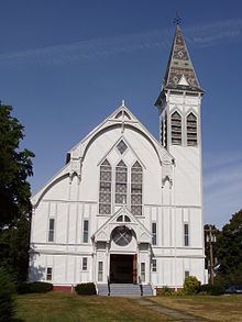
- Points of interest
- Notable people
- Popular culture
- References
Map of Georgetown, MA, USA
History
Georgetown was originally settled in 1639 as a part of the town of Rowley by the Reverend Ezekiel Rogers. The town at the time stretched from the Atlantic coast to the Merrimack River, south of Newbury and north of Ipswich. Several farmers, finding suitable meadowlands in the western half of the settlement, began settling along the Penn Brook by the middle of the seventeenth century, creating Rowley's West Parish. Though not directly involved in King Philip's War, the village nonetheless did become a victim of Indian raids. The village, which became known as New Rowley, grew for many years, with small mills and eventually a shoe company opening up in the town. By 1838, the town was sufficiently large enough for its own incorporation, and was renamed Georgetown. Small industry continued, and today the town is mostly residential in nature, a distant suburb of Boston's North Shore.
Geography
According to the United States Census Bureau, the town has a total area of 13.2 square miles (34.1 km2), of which 12.9 square miles (33.3 km2) is land and 0.31 square miles (0.8 km2), or 2.20%, is water. Georgetown is located on the edge of the hills and coastal plain of northeastern Massachusetts. It has many streams and brooks, as well as two major ponds, Rock Pond and Pentucket Pond. The town has several areas of protected land, including the Georgetown-Rowley State Forest to the south, the Crane Pond Wildlife Management Area to the north, the Lufkins Brook Area to the west, and a small portion of the Boxford State Forest in the southwest.
Georgetown is located approximately 10 miles (16 km) east of Lawrence and 28 miles (45 km) north of Boston, north of the center of Essex County. It is about 30 minutes north of Boston. It is bordered by Groveland to the northwest, Newbury to the northeast, Rowley to the southeast, and Boxford to the southwest. Interstate 95 crosses through the eastern half of town, with one exit within the town, at Route 133. Route 133 crosses from east to west through town, with Route 97 crossing from northwest to south. Both state routes share a short stretch of road near the town center. The town has no mass transit; the nearest rail service can be found along the Newburyport/Rockport Line of the MBTA Commuter Rail in Rowley. The nearest air service is at Logan International Airport.
Demographics
As of the census of 2000, there were 7,377 people, 2,566 households, and 2,024 families residing in the town. The population density was 570.2 people per square mile (220.1/km²). There were 2,616 housing units at an average density of 202.2 per square mile (78.1/km²). The racial makeup of the town was 98.52% White, 0.15% African American, 0.14% Native American, 0.42% Asian, 0.31% from other races, and 0.46% from two or more races. Hispanic or Latino of any race were 0.64% of the population.
There were 2,566 households out of which 41.7% had children under the age of 18 living with them, 70.8% were married couples living together, 6.2% had a female householder with no husband present, and 21.1% were non-families. 16.9% of all households were made up of individuals and 7.6% had someone living alone who was 65 years of age or older. The average household size was 2.87 and the average family size was 3.27.
In the town, the population was spread out with 28.6% under the age of 18, 5.0% from 18 to 24, 31.9% from 25 to 44, 25.1% from 45 to 64, and 9.4% who were 65 years of age or older. The median age was 37 years. For every 100 females there were 98.6 males. For every 100 females age 18 and over, there were 94.2 males.
According to the 2010 census the median income for a household in the town was $108,137, and in 2008 the median income for a family was $79,649. Males had a median income of $58,806 versus $36,108 for females. The per capita income for the town was $28,846. About 2.7% of families and 4.2% of the population were below the poverty line, including 3.8% of those under age 18 and 5.5% of those age 65 or over.
Government
Georgetown employs the open town meeting form of government, and is led by a board of selectmen and a town administrator. The current selectmen are C. David Surface (Chairman), Douglas Dawes, Steven Sadler, Joseph Bonavita, and Gary Fowler. Georgetown has its own police department, two fire stations (Central Station in downtown and Erie Station in the Northern sector of town), a post office, library, electric department and highway department. The nearest hospitals to the town are in Haverhill, Newburyport and Beverly.
On the state level, Georgetown is under the jurisdiction of the Central District Court of Essex County, located in Haverhill. It is patrolled by the Newbury barracks of Troop A of the Massachusetts State Police. In state government, Georgetown is part of the Second and Eighteenth Essex Districts in the Massachusetts House of Representatives, and is part of the First Essex and Middlesex District in the Massachusetts Senate. On the national level, Georgetown is in Massachusetts's 6th congressional district, and has been represented since 2015 by Seth Moulton (D). In the United States Senate, Massachusetts's senior senator, elected in 2012, is Elizabeth Warren (D), and its junior senator, elected in 2013, is Edward Markey (D).
Education
Georgetown, unlike its neighboring municipalities, has its own municipal school district, and is not part of a regional school association or district. Georgetown has three schools:
Georgetown High School's colors are royal blue and white, and its team name is the Royals, with a mounted knight as its mascot. They compete in the Small School division of the Cape Ann League, and have a Thanksgiving Day football rivalry with Manchester-Essex Regional High School. In addition to GHS, high school students may also attend Whittier Regional Vocational Technical High School in Haverhill, which serves as the eastern Merrimack Valley's vocational school. Private schools are also located throughout the area, the nearest being The Governor's Academy in Newbury.