
 | ||
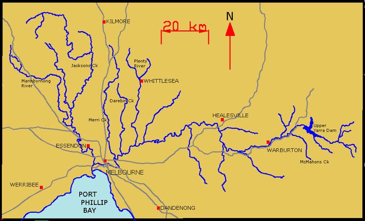
The Yarra River is a river in East-Central Victoria, Australia that flows through the city of Melbourne. This article contains explanations and lists of the river's tributaries and other geographic features. The river flows atop layers of silt that built up within an ancient river valley around 10,000-15,000 years ago.
Contents
The river's major tributaries are the Plenty River, Merri Creek, Darebin Creek, Diamond Creek, Gardiners Creek, Mullum Mullum Creek and the Moonee Ponds Creek. It hosts a wide range of geographic features including; bends, rapids, lakes, islands, floodplains, billabongs, wetlands, etc. Most features have been named after translated Woiwurrung phrases or have European, particularly British, origins.
Tributaries
The Yarra River has about 50 named tributaries in total; 6 rivers, 42 creeks and 2 gullies. At its most easterly point, it is fed by many small unnamed creeks and streams that begin in the Yarra Ranges within the Yarra Ranges National Park, which are sometimes fed by snowfalls. Below is a list of its tributaries (from downstream to upstream):
The ordering of the basin, from downstream to upstream, is:
Geographical features
The Yarra River hosts a wide range of geographical features, perhaps the most plentiful of which are billabongs, of which there are over 100, particularly in the floodplains near Yering, Yarra Glen and Coldstream. Being a considerably thin river for almost its entire length, there are very few islands or lakes. In the middle reaches there are a few rapids of easy to moderate difficulty, however these are sparsely distributed. Below is a list of the river's geographical features, including tributaries (shown in bold) and man-made features or townships (shown in italics), for bearings (from downstream to upstream):