
 | ||
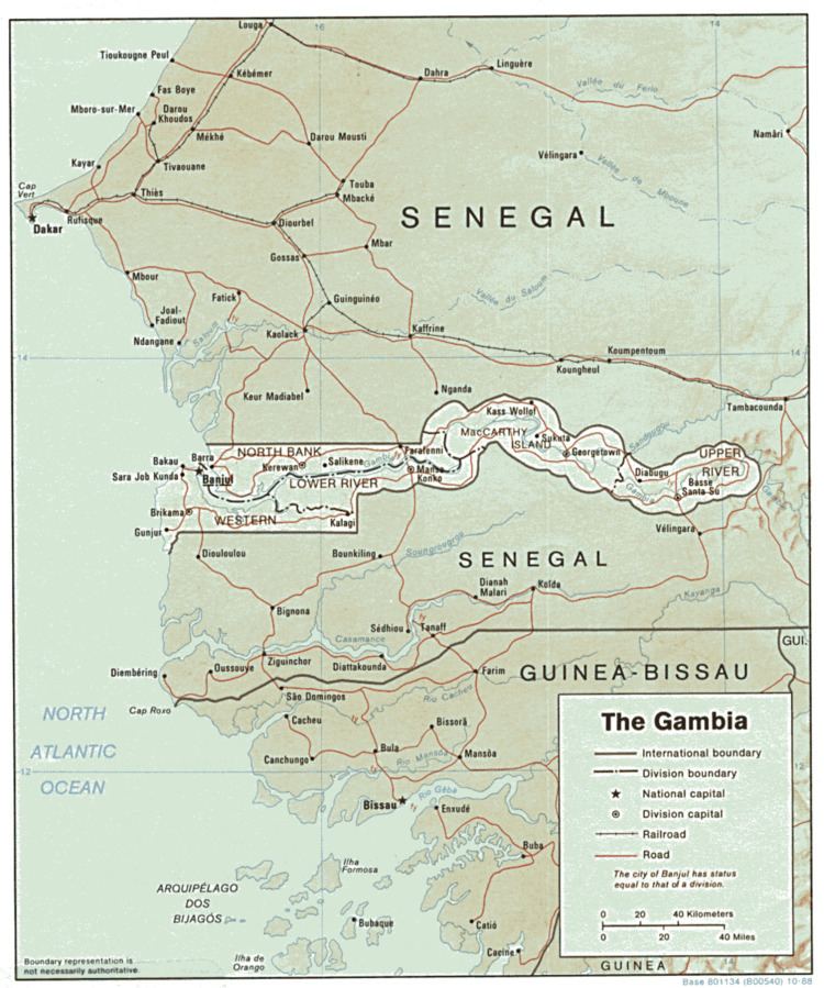
The Gambia is a very small and narrow country with the border based on the Gambia River. The country is less than 48 km wide at its greatest width. The country's present boundaries were defined in 1889 after an agreement between the United Kingdom and France. It is often claimed by Gambians that the distance of the borders from the Gambia River corresponds to the area that British naval cannon of the time could reach from the river's channel. However, there is no historical evidence to support the story, and the border was actually delineated using careful surveying methods by the Franco-British boundary commission. Apart from its coastline, where the Gambia borders the Atlantic Ocean, it is an enclave of Senegal and is by far the smallest country on mainland Africa.
Contents
Climate
The Gambia has a subtropical climate with distinct dry and rainy seasons.
From November to mid-May there is uninterrupted dry weather, with temperatures as low as 16 °C (60.8 °F) in Banjul and surrounding areas.
Hot, humid weather predominates the rest of the year, with a rainy season from June to October; during this period, temperatures may rise as high as 43 °C (109.4 °F) but are usually lower near the sea.
Mean temperatures range from 23 °C (73.4 °F) in January to 27 °C (80.6 °F) in June along the coast, and from 24 °C (75.2 °F) in January to 32 °C (89.6 °F) in May inland. The average annual rainfall ranges from 920 mm (36.2 in) in the interior to 1,450 mm (57.1 in) along the coast.
Terrain
The grassy flood plain of the Gambia river contains Guinean mangroves near the coast, and becomes West Sudanian savanna upriver inland.
Statistics
Location: Western Africa, bordering the North Atlantic Ocean and Senegal
Geographic coordinates: 13°28′N 16°34′W
Area:
total: 11,295 km²
land: 10,000 km²
water: 1,295 km²
Land boundaries:
total: 749 km
border countries: Senegal 749 km
Coastline: 80 km
lowest point: Atlantic Ocean 0 m
highest point: Red Rock 53 m
Natural resources: fish, clay, silica sand, titanium (rutile and ilmenite), tin, zircon
Land use:
arable land: 43.48%
permanent crops: 0.49%
other: 56.03% (2011)
total: 0.09 km3/yr (41%/21%/39%)
per capita: 65.77 m3/yr (2005)
Current issues: deforestation, desertification, prevalence of water-borne diseases, drought (rainfall has dropped by 30% in the last 30 years)
Environment - party to international agreements on:
Extreme points
This is a list of the extreme points of the Gambia, the points that are farther north, south, east or west than any other location.