
 | ||
Slovenia is situated in Central Europe touching the Alps and bordering the Mediterranean. The Alps — including the Julian Alps, the Kamnik-Savinja Alps and the Karavanke chain, as well as the Pohorje massif — dominate Northern Slovenia along its long border to Austria. Slovenia's Adriatic coastline stretches approximately43 km (27 mi) from Italy to Croatia. Its part south of Sava river belongs to Balkan peninsula - Balkans.
Contents
- Location
- Geographic coordinates
- Area
- Borders
- Historical regions
- Climate
- Terrain
- Elevation extremes
- Current issues
- International agreements
- References
The term "Karst" originated in southwestern Slovenia's Karst Plateau (Slovene: Kras), a limestone region of underground rivers, gorges, and caves, between Ljubljana and the Mediterranean.
On the Pannonian plain to the East and Northeast, toward the Croatian and Hungarian borders, the landscape is essentially flat. However, the majority of Slovenian terrain is hilly or mountainous, with around 90% of the surface 200 meters or more above sea level.
Location
Slovenia's location is where southeastern and Central Europe meet, where the Eastern Alps border the Adriatic Sea between Austria and Croatia. The 15th meridian east almost corresponds to the middle line of the country in the direction west-east.
Geographic coordinates
Extreme geographical points of Slovenia:
The maximum north-south distance is 1°28' or 163 km (101 mi).
The maximum east-west distance is 3°13' or 248 km (154 mi).
The geometric centre of Slovenia (GEOSS) is located at 46°07′11.8″N 14°48′55.2″E.
Since 2016, the geodetic system of Slovenia with the elevation benchmark of 0 m has its origin at the Koper tide gauge station. Until then, it referred to the Sartorio mole in Trieste (see metres above the Adriatic).
Area
Borders
The entire Slovenian coastline is located on the Gulf of Trieste. Towns along the coastline include:
Historical regions
The traditional Slovenian regions, based on the former division of Slovenia into the four Habsburg crown lands of (Carniola, Carinthia, Styria, and the Littoral) and their parts, are:
The last two are usually considered together as the Littoral Region (Primorska). White Carniola (Bela krajina), otherwise part of Lower Carniola, is usually considered a separate region, as is the Central Sava Valley (Zasavje), which is otherwise a part of Upper and Lower Carniola and Styria.
Slovenian Littoral has no natural island, but there is a plan on building an artificial one.
Climate
Humid subtropical climate on the coast, continental climate with mild to hot summers and cold winters in the plateaus and in the valleys to the east. Precipitation is high away from the coast, with the spring being particularly prone to rainfall. Slovenia's Alps have frequent snowfalls during the winter.
Terrain
A short coastal strip on the Adriatic Sea, an alpine mountain region adjacent to Italy and Austria, mixed mountain and valleys with numerous rivers to the east.
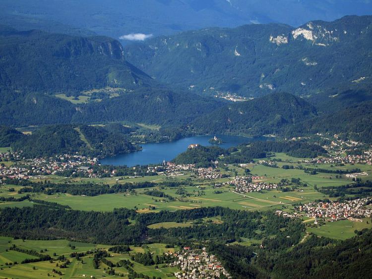
There is only one natural island in Slovenia: Bled Island in Lake Bled in the country's northwest.
Elevation extremes
Current issues
The Sava River polluted with domestic and industrial waste; pollution of coastal waters with heavy metals and toxic chemicals; forest damage near Koper from air pollution (originating at metallurgical and chemical plants) and resulting acid rain.