
Continent Australia | Coastline 2,137 km (1,328 mi) | |
 | ||
Area Ranked 3rd among states and territories Highest point Mount Kosciuszko2228 m (7,310 ft) Longest river Murray River1721 km (1,069 mi) | ||
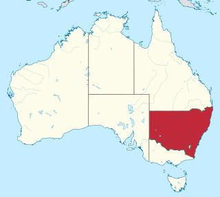
New South Wales (NSW) is Australia's most populous state, located in the east coast of the continent. It is in the southern hemisphere between latitudes 28 and 38 degrees south of the equator and longitudes 143 and 154 degrees east of the Universal Prime Meridian (formerly known as the Greenwich meridian). The state is in the warm temperate climatic zone.
The area of New South Wales is 809,444 km2 (312,528 sq mi). The coastline is 2,137 km (1,328 mi) in length.
Cape Byron, in the north-east of the state, is Australia's most easterly mainland point.
The state is bordered on the north by Queensland, on the west by South Australia, and on the south by Victoria. Its coast faces the Tasman Sea. New South Wales contains two Federal enclaves: the Australian Capital Territory (ACT), and the Jervis Bay Territory.
New South Wales can be divided physically into four sections:
The steep escarpment of the Blue Mountains to the west of Sydney prevented European exploration beyond the coastal strip for several years until explorer Gregory Blaxland found a way through in 1813, 25 years after the first settlement in Sydney.
Cities and towns
Its four main cities from north to south are Newcastle, Gosford, Sydney, and Wollongong which all lie along the coast. Other cities and towns include Albury, Broken Hill, Dubbo, Tamworth, Armidale, Lismore, Nowra, Griffith, Leeton, Wagga Wagga, Goulburn and Coffs Harbour. Ashbury New South Wales