
Population 1,264,866 (2007) Elevation 828 m | Highest elevation 828 m (2,717 ft) Pop. density 616 /km (1,595 /sq mi) Area 2,011 km² | |
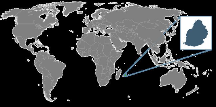 | ||
Mauritius is an island off Africa's southeast coast located in the Indian Ocean, east of Madagascar.
Contents
Climate
The local climate is tropical, modified by southeast trade winds; there is a warm, dry winter from May to November and a hot, wet, and humid summer from November to May. Anti-cyclones affect the country during May to September.
Cyclones affect Mauritius during November–April. Hollanda (1994) and Dina (2002) were the worst two last cyclones to have affected the island.
Statistics
Location: Southeastern Africa, island in the Indian Ocean, east of Madagascar Geographic coordinates: 20°17′S 57°33′E
Map references: World
Area (includes Agaléga, Cargados Carajos (Saint Brandon), and Rodrigues):
total: 2,011 km²
land: 2,030 km²
water: 10 km²
note: includes Agalega Islands, Cargados Carajos Shoais (Saint Brandon), and Rodrigues
Land boundaries: 0 km
Coastline: 177 km
Maritime claims: territorial sea: 12 nmi (22.2 km; 13.8 mi)
continental shelf: 200 nmi (370.4 km; 230.2 mi) or to the edge of the continental margin
exclusive economic zone: 200 nmi (370.4 km; 230.2 mi)
Terrain: small coastal plain rising to discontinuous mountains encircling central plateau
Elevation extremes:
lowest point: Indian Ocean 0 m
highest point: Piton de la Petite Rivière Noire 828 m
Natural resources: arable land, fish
Land use:
arable land: 38.24%
permanent crops: 1.96%
other: 59.80% (2011)
Irrigated land: 212.2 km² (2003)
Total renewable water resources: 2.75 km3 (2011)
Natural hazards: cyclones (November to April); almost completely surrounded by reefs that may pose maritime hazards
Environment - current issues: water pollution, degradation of coral reefs
Environment - international agreements:
party to: Antarctic-Marine Living Resources, Biodiversity, Climate Change, Climate Change-Kyoto Protocol, Desertification, Endangered Species, Environmental Modification, Hazardous Wastes, Law of the Sea, Marine Life Conservation, Ozone Layer Protection, Ship Pollution, Wetlands
signed, but not ratified: none of the selected agreements
Geography - note: The main island, from which the country derives its name, is of volcanic origin and is almost entirely surrounded by coral reefs; former home of the dodo, a large flightless bird related to pigeons, driven to extinction by the end of the 17th century through a combination of hunting and the introduction of predatory species
Table of Islands
notes: excludes Tromelin and other îles éparses
Extreme points
This is a list of the extreme points of Mauritius, the points that are farther north, south, east or west than any other location.