 | ||
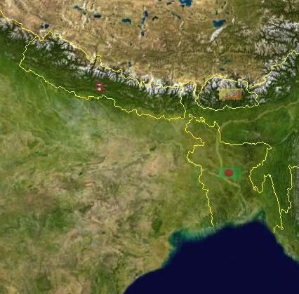
Bihar is located in the eastern region of India between latitude 24°-20'-10" N ~ 27°-31'-15" N and longitude 83°-19'-50" E ~ 88°-17'-40" E. It is an entirely land–locked state, in a Sub Tropical region of the Temperate zone. Bihar lies mid between the humid West Bengal in the east and the sub humid Uttar Pradesh in the west which provides it with a transitional position in respect of climate, economy and culture. It is bounded by Nepal in the north and by Jharkhand in the south. Bihar plain is divided into two unequal halves (North Bihar and South Bihar) by the river Ganges which flows through the middle from west to east. Bihar's land has average elevation above sea level is 173 feet.
Contents
Political geography
The state is divided into 9 divisions and 38 districts, for administrative purposes. which are listed below.
Geology
Bihar is in Indo-Gangetic plain so naturally fertile soil is one asset of the state. Thus Indo-Gangetic plain's soil is the backbone of agricultural and industrial development. The Indo-Gangetic plain in Bihar consists of a thick alluvial mantle of drift origin overlying in most part, the siwalik and older tertiary rocks. The soil is mainly little young loam rejuvenated every year by constant deposition of silt, clay and sand brought by streams but mainly by floods in Bihar
This soil is deficient in phosphoric acid, nitrogen and humus, but potash and lime are usually present in sufficient quantity. The most common soil in Bihar is Gangetic alluvium of Indo-Gangetic plain region, Piedmont Swamp Soil which is found in northwestern part of West Champaran district and Terai Soil which is found in northern part of Bihar along the border of Nepal. clay soil, sand soil and loamy soil are common in Bihar.
Hills
Flood
Bihar is India's most flood-prone State, with 76% of the population in the north Bihar living under the recurring threat of flood devastation. According to some historical data, 16.5% of the total flood affected area in India is located in Bihar while 22.1% of the flood affected population in India lives in Bihar. About 68,800 square kilometres (26,600 sq mi) out of total geographical area of 94,160 square kilometres (36,360 sq mi) comprising 73.06% is flood affected. Floods in Bihar are a recurring disaster which on an annual basis destroys thousands of human lives apart from livestock and assets worth millions.
Climate
Bihar is cold in the winter, the lowest temperatures being around 0–10 degrees Celsius (32 to 50 degrees Fahrenheit). Winter months are December and January. It is hot in the summer with average highs around 35–45 Celsius ( 95–105 Fahrenheit). April to mid June are the hot months. The monsoon months of June, July, August, and September see good rainfall. October & November and February & March have pleasant climate.
