
Country United States Area code(s) 334 Elevation 61 m Local time Saturday 2:54 AM | Time zone Central (CST) (UTC-6) FIPS code 01-67800 Zip code 36477 Population 1,925 (2013) | |
 | ||
Weather 12°C, Wind S at 0 km/h, 98% Humidity | ||
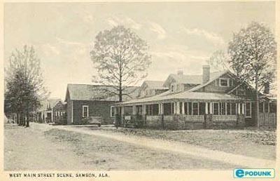
Samson is a city in Geneva County, Alabama, United States. It is part of the Dothan, Alabama Metropolitan Statistical Area. At the 2010 census the population was 1,940, down from 2,071 in 2000. Samson incorporated in 1905 (according to the 1910 U.S. Census), although other sources cited 1906.
Contents
Map of Samson, AL 36477, USA
Geography
Samson is located at 31°6′45″N 86°2′52″W (31.112574, -86.047865).
According to the U.S. Census Bureau, the city has a total area of 3.6 square miles (9.3 km2), of which 3.6 square miles (9.3 km2) is land and 0.28% is water.
Demographics
As of the census of 2000, there were 2,071 people, 894 households, and 575 families residing in the city. The population density was 572.1 people per square mile (220.9/km²). There were 1,016 housing units at an average density of 280.7 per square mile (108.4/km²). The racial makeup of the city was 77.11% White, 20.42% Black or African American, 0.97% Native American, 0.63% from other races, and 0.87% from two or more races. 2.46% of the population were Hispanic or Latino of any race.
There were 894 households out of which 28.6% had children under the age of 18 living with them, 44.4% were married couples living together, 16.8% had a female householder with no husband present, and 35.6% were non-families. 33.3% of all households were made up of individuals and 16.1% had someone living alone who was 65 years of age or older. The average household size was 2.32 and the average family size was 2.92.
In the city, the population was spread out with 25.5% under the age of 18, 7.5% from 18 to 24, 24.8% from 25 to 44, 24.3% from 45 to 64, and 17.9% who were 65 years of age or older. The median age was 38 years. For every 100 females there were 86.9 males. For every 100 females age 18 and over, there were 80.5 males.
The median income for a household in the city was $18,594, and the median income for a family was $25,188. Males had a median income of $25,767 versus $16,719 for females. The per capita income for the city was $12,834. About 29.2% of families and 33.8% of the population were below the poverty line, including 51.1% of those under age 18 and 32.0% of those age 65 or over.
2010 census
As of the census of 2010, there were 1,940 people, 814 households, and 513 families residing in the city. The population density was 538.9 people per square mile (206.4/km²). There were 968 housing units at an average density of 268.9 per square mile (103.0/km²). The racial makeup of the city was 73.3% White, 17.9% Black or African American, 1.1% Native American, 5.2% from other races, and 2.1% from two or more races. 8.3% of the population were Hispanic or Latino of any race.
There were 814 households out of which 25.6% had children under the age of 18 living with them, 36.2% were married couples living together, 20.1% had a female householder with no husband present, and 37.0% were non-families. 32.3% of all households were made up of individuals and 13.6% had someone living alone who was 65 years of age or older. The average household size was 2.38 and the average family size was 3.05.
In the city, the population was spread out with 24.6% under the age of 18, 8.6% from 18 to 24, 24.8% from 25 to 44, 25.6% from 45 to 64, and 16.4% who were 65 years of age or older. The median age was 38.1 years. For every 100 females there were 90.0 males. For every 100 females age 18 and over, there were 90.7 males.
The median income for a household in the city was $18,768, and the median income for a family was $25,060. Males had a median income of $29,167 versus $19,682 for females. The per capita income for the city was $11,606. About 31.6% of families and 32.5% of the population were below the poverty line, including 44.7% of those under age 18 and 19.4% of those age 65 or over.
Notable people
2009 massacre
On March 10, 2009, in the Alabama towns of Kinston, Samson and Geneva, Michael McLendon killed ten people and wounded six others in a shooting rampage before committing suicide. In response, troops from nearby Fort Rucker were deployed to the streets of Samson where they manned barricades and guarded a makeshift morgue. This was later determined to be in violation of the Posse Comitatus Act, which prohibits federal troops from performing law enforcement actions.