
UBIGEO 1802 | Elevation 2,166 m (7,106 ft) Area 5,682 km² Region Moquegua Region | |
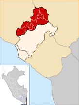 | ||
The General Sánchez Cerro Province is the smallest of three provinces in the Moquegua Region of Peru. The capital of the province is Omate. The province was named after the former Peruvian army officer and president Luis Miguel Sánchez Cerro.
Contents
- Map of General SC3A1nchez Cerro Province Peru
- Boundaries
- Geography
- Political division
- Ethnic groups
- References
Map of General S%C3%A1nchez Cerro Province, Peru
Boundaries
Geography
One of the highest peaks of the province is the Ubinas volcano. Other mountains are listed below:
Political division
The province is divided into eleven districts, which are:
Ethnic groups
The province is inhabited by indigenous citizens of Aymara and Quechua descent. Spanish, however, is the language which the majority of the population (60.36%) learnt to speak in childhood, 37.45% of the residents started speaking using the Quechua language and 1.98% using Aymara (2007 Peru Census).
References
General Sánchez Cerro Province Wikipedia(Text) CC BY-SA