Elevation 2,116 m | Prominence 56 m | |
 | ||
Similar Monte Bar, Camoghè, Cima di Fojorina, Denti della Vecchia, Monte Boglia | ||
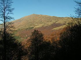
The Gazzirola (also known as Garzirola) is a mountain of the Lugano Prealps on the Swiss-Italian border.
Contents
Map of Gazzirola, 22010 Piano Cuescio, Switzerland
SOIUSA classification
According to the SOIUSA (International Standardized Mountain Subdivision of the Alps) the mountain can be classified in the following way:
Mountain huts
Not far from the mountain are located three mountain huts: Capanna San Lucio (1,540 m), Rifugio San Lucio (1,554 m) and Rifugio Garzirola (1,974 m).
References
Gazzirola Wikipedia(Text) CC BY-SA
