
Population 4,132 (2011) | Subregion Alto Alentejo Parishes 4 Area 294.6 km² Local time Saturday 5:53 AM Region Alentejo | |
 | ||
Weather 12°C, Wind W at 6 km/h, 83% Humidity | ||
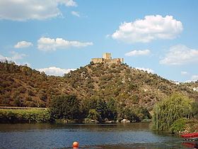
Gavião ([ɡɐviˈɐ̃w]) is a Portuguese municipality in the District of Portalegre, in the historical region of Alentejo. The population in 2011 was 4,132, in an area of 294.59 km².
Contents
Map of Gavi%C3%A3o, Portugal
The municipality is bounded by Mação to the West and North, Nisa to the East, Crato to the Southeast, Ponte de Sôr to the Southwest and Abrantes to the West.
Gavião received a foral from King D. Manuel I of Portugal on November the 23rd of 1519, nowadays, that day is celebrated as municipal holiday.
Parishes
The municipality is composed of 4 parishes:
Natives
References
Gavião, Portugal Wikipedia(Text) CC BY-SA