
Prominence 950 m | Elevation 1,883 m First ascent 1810 | |
 | ||
Isolation 94.9 kilometres (59.0 mi) Easiest route Elevator system inside mountain.Or hike from a parking place on the southeastern side. Similar Galdhøpiggen, Besseggen, Kjerag, Trolltunga, Snøhetta | ||
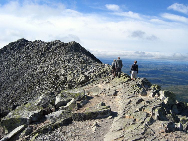
Gaustatoppen is the highest mountain in the county Telemark in Norway who lies in the municipality Tinn and Hjartdal. The view from the summit is impressive, as one can see an area of approximately 60,000 km², one sixth of Norway's mainland. The mountain is popular for downhill skiing in winter, and competitions have been held on its slopes. These competitions include the "Norseman triathlon", billed as "the world's most brutal iron-distance triathlon". It starts in Eidfjord and finishes at the top of Gaustatoppen. The summit is accessible on foot in the summer, on a rocky pathway of medium difficulty, although the southern side of the mountain is very dangerous and inaccessible. The wreckage of an airplane crash lies there, as it is too difficult to remove it.
Contents
Map of Gaustatoppen, 3660 Rjukan, Norway
The nameEdit
The first element is Gausta, the name of the whole mountain, the last element is the finite form of topp m 'top, summit'. The name Gausta is probably a shortened form for *Gaustafjell (Gausta mountain), because Gausta originally was the name of a farm beneath the mountain. (For the same development see Dovre.) The Old Norse form of the name was maybe *Gautstǫð, the name is then a compound of gaut f 'flooded place', and stǫð f 'stead, landing place for boat'. (The farm lies at Rjukan river.)
RailwayEdit
There is a funicular railway inside the mountain, built for military purposes. This ascends from the base of the mountain almost to the summit. A short railway takes the passengers from the mountain base horizontally to the lower station deep inside the mountain. It was built to access the military radio relay station built at and inside the mountain top.The installation is now a tourist attraction. It was financed mainly by american military grants, and cost one million US dollars to build from 1954 to 1959.