
Type Track Fuel supply Kunawaritji | Length 323 km (201 mi) Facilities None | |
 | ||
The Gary Highway is a remote unsealed track in central Western Australia running through the Gibson Desert and the Great Sandy Desert. It was built by Len Beadell's Gunbarrel Road Construction Party in April and May 1963 and named after Beadell's son who was born in February that year. It connects the Gunbarrel Highway from Everard Junction in the south, to the Gary Junction Road at Gary Junction in the north. It is one of only two north-south tracks in the central deserts of Western Australia, the other being the Sandy Blight Junction Road, also built by Len Beadell.
Contents
Points of interest
The Gary Highway passes several interesting points in its 323 kilometres (201 mi) desert crossing:
Description
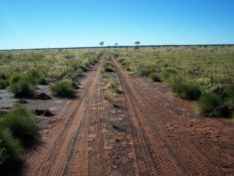
The track is single lane, relatively clear of scrub, but corrugated over its entire length. It is mostly straight, except for a section from 22.85ºS to 22.88ºS where the track diverts around sand dunes. It was navigable (Sep 2007) with a hard surface of sand and gravel. The southern end has several wash-aways in the Gibson Desert Nature Reserve.
The approximate length of the track is 425 kilometres (264 mi), including side trips to Veevers Crater and McPhersons Pillar. It is very remote with both ends being hundreds of kilometres from any settlements or supply points. An HF radio or satellite phone should be carried as there are no facilities along this track and travellers should be self-sufficient in fuel, food, water and vehicle support. The nearest northern supplies are at Kunawarritji near Well 33 on the Canning Stock Route and Kiwirrkurra on the Gary Junction Road, or to the south some 300 kilometres (190 mi) south east of Everard Junction at Warburton Roadhouse or Carnegie Station to the west.