
Country United States County Garfield GNIS feature ID 1100216 Local time Saturday 3:19 PM | Time zone CST (UTC-6) Elevation 1,314 m Area code 580 | |
 | ||
Weather 17°C, Wind S at 43 km/h, 53% Humidity | ||
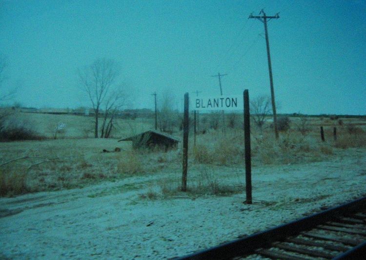
Blanton is an unincorporated community in Garfield County, Oklahoma, United States. It was a rail stop for two rail lines, one of which used to transport grain until the mid-1990s. It was named after Denver, Enid, & Gulf railroad executive W.B. Blanton.
Contents
Map of Blanton, Enid, OK 73703, USA
History
As early as 1909, Blanton was a rail stop for the St. Louis-San Francisco Railway. A second railline existed at Blanton junction, running to Kiowa, Kansas. This line, originally built for the Denver, Enid and Gulf Railroad, and later sold to Atchison, Topeka and Santa Fe was used to transport grain until the mid-1990s.
Geography
Blanton is located at 36°25′38″N 97°55′35″W, 3.4 miles WNW of Enid, Oklahoma. It is a part of the Lower Cimarron-Skeleton Watershed.
Blanton is currently located on mile 548.2 of the main track of BNSF Railway's Texas Division.