
Established 2009 Time zone ACST (UTC+9:30) Founded 2009 | Postcode(s) 5960 Postal code 5960 | |
 | ||
Location 15 km (9 mi) north-west of Adelaide city centre | ||
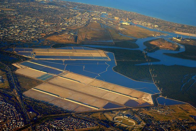
Garden Island is a locality in the Australian state of South Australia located in the Adelaide metropolitan area within the estuary of the Port Adelaide River about 15 kilometres (9.3 mi) north-west of the Adelaide city centre. Its boundaries which were created in August 2009 include “the whole of the geographical feature of Garden Island” and parts of the following water bodies that adjoin the shoreline of the ‘geographic feature’ - Angas Inlet to the north, the North Arm to the south and Eastern Passage to the east. Garden Island is located within the federal division of Port Adelaide and the state electoral district of Port Adelaide Since at least 2009, Garden Island has not been located within a local government area.
Contents
Map of Garden Island SA 5960, Australia
Current use
As of 2014, the majority of the land within the locality is zoned as "MFP" which refers to the Multifunction Polis, a proposed development with the Adelaide metropolitan area to create “an international and national centre for co-operative research and innovation in science, technology, environmental management, education and the arts.” The Garden Island Yacht Club and Angus Inlet Boat Club have private facilities on Garden Island. Public facilities include a boat ramp, a fishing jetty, car parking and a public toilet block. The boat ramp is used to launch and retrieve powered and unpowered recreational watercraft.