
- left Cooney Creek - elevation 1,280 m (4,199 ft) | - location near Llangothlin - elevation 388 m (1,273 ft) | |
 | ||
Sources Ben Lomond, Great Dividing Range | ||
Gara River, a perennial river that is a tributary of the Macleay River, is located in the Northern Tablelands region of New South Wales, Australia.
Contents
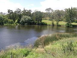
Map of Gara River, New South Wales, Australia
Course and featuresEdit
The river rises at the junction of the southern slopes of the Great Dividing Range and the Ben Lomond Range, near Llangothlin, and flows generally south and southeast, joined by four minor tributaries, until the river reaches a junction with Salisbury Waters within Oxley Wild Rivers National Park and descends to its confluence with the Macleay River, below Blue Nobby Mountain, south east of Armidale. The river descends 892 metres (2,927 ft) over its 91 kilometres (57 mi) course and is impounded by Guyra Dam and Malpas Reservoir.
In its lower reaches, the Gara River is transversed by the Waterfall Way.