
Max. length 2.1 km (1.3 mi) Surface area 2.2 km (0.85 sq mi) Surface elevation 1,294 m | Max. width 1.6 km (0.99 mi) Designated 22 March 2004 Area 220 ha | |
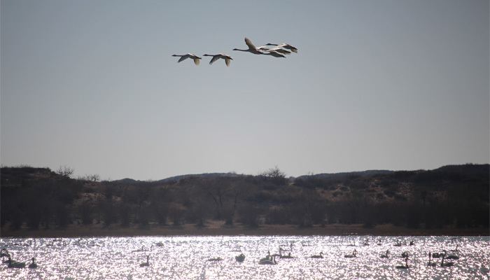 | ||
Ganga Lake (Mongolian: Ганга нуур) is a saltwater lake located in Dariganga sum, Sükhbaatar Province, Mongolia. The lake lies on the transition zone between the southern steppes and the Gobi desert, giving it a unique landscape of lakes, steppes, and sand dunes. The lake and its wetlands (of which the total area is 32.8 km²) is an important breeding and resting area for endangered migratory birds, including the great crested grebe, the whooper swan, and the ruddy shelduck.
Contents
Map of Ganga Lake, Mongolia
Due to ongoing climate change, the lake area is shrinking.
Neighboring lakes include Duut Lake, Sumtiin Lake, Erdene Lake, Kholboo Lake, Züün Kholboo Lake, Tsagaan Lake, Khoshmogt Lake, Red Lake (dried up), and Zegst Lake.
The lake and its surrounding wetlands was designated a Ramsar site in 2004.
Naming
The name Ganga is another term for the River Ganges. A folk legend states that the 18th century Mongol nobleman Togtokhtör wang had two flasks of water brought from the holy river and put in the lake, thereby giving the lake its name.