
Max. length 56 km (35 mi) Surface area 113.2 km (43.7 sq mi) Area 113.2 km² Mean depth 105 m | Max. width 7 km (4.3 mi) Average depth 105.4 m (346 ft) Surface elevation 29 m Width 7 km | |
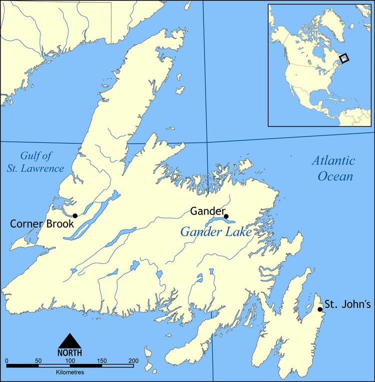 | ||
Gander Lake is located in the central part of the Canadian island of Newfoundland in the province of Newfoundland and Labrador. It is the third-largest lake on Newfoundland.
Contents
Map of Gander Lake, Newfoundland and Labrador, Canada
Measuring 56 km (35 mi) in length and several kilometres in width, the lake is oriented roughly northwest–southeast. The town of Gander is located on the Northern shore at roughly its midpoint, and the towns of Appleton and Glenwood are situated on the Western extremity of the lake, on the banks of the Gander River. Gander Lake has been measured to a depth of 288 m (945 ft) in some areas.
It is the main source of water for the towns of Gander, Appleton and Glenwood.
AccessEdit
Near the southeastern end of the lake, just over 12 km (7.5 mi) outside of the town of Gander, there is a small, quarry-cut, artificial harbour, commonly known as "Little Harbour". This area is a public boat launch. The area hosts three separate boat launch docks, the largest of which was rebuilt in the summer of 1997. The docks are commonly used by the local swimmers as diving platforms. The harbour also contains a concrete boat launch and a fire pit area for day trips. Camping is frowned upon, if not outright forbidden in the immediate area of the boat launch. However there are several pebble beaches which are used by tenters, accessible from a hiking trail over a rocky hill to the northwest. Boaters have much better access to both pebble and sand beaches. There are many long stretches of beaches, such as one commonly known as the "fifteen mile brook", which are excellent for camping. Other well known areas throughout the lake include "Hunt's Cove", "Southwest" and "Gander River".