
Elevation 2,127 m (6,978 ft) | Peak Trevinca | |
 | ||
Types of rock Schist, Gneiss, Granite, Slate | ||
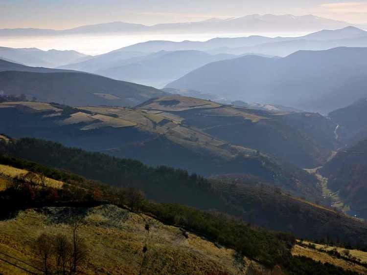
The Galician Massif, Spanish: Macizo Galaico, also known as Macizo Galaico-Leonés, is a system of mountain ranges in the northwestern corner of the Iberian Peninsula. It is located in Galicia with its southeastern end reaching into the provinces of Zamora and León of Castile and León. Its highest point is Pena Trevinca at 2,127 metres (6,978 ft) . Another important peak is Cabeza de Manzaneda (1,781 m).
Contents
In traditional local folklore the forests of the Galician System are said to be inhabited by a variety of elves, fairies, ghosts, the Santa Compaña, the Nubeiro and witches (meigas).
GeologyEdit
Geomorphologically the Galician Massif is a northwestern prolongation of the Meseta Central, the inner Iberian plateau and has great affinity with the geology of the Tras os Montes Portuguese region, so that it is considered as a whole under the name 'Galicia-Trás-os-Montes Zone'. It is composed of Paleozoic materials (granite) with metamorphic rocks such as gneiss, slate and schist in the center and west, which were subject to Alpine folding. Its eastern end merges with the Cantabrian Mountains.
The relief of the system, with an average height of 500 metres (1,600 ft), is relatively smooth compared with other Iberian ranges. It is however very complex, having no defined structural alignment owing to the heavy fluvial erosion that has fragmented the terrain.
Generally the system includes mountains that are rounded in shape, often topped by small rocky outcrops, as well as horsts, basins and faults, roughly aligned in a N-S direction.
VegetationEdit
Since rain is abundant in Galicia, the undisturbed areas of the massif have a soft soil texture and are covered in dense vegetation of temperate deciduous forest where Quercus petraea and Quercus robur oaks predominate. The woods alternate with shrubland and wide natural meadows.
The vegetation is quite homogeneous throughout the massif and there is great plant biodiversity in the Galician mountains. Many of the species found in the mountains were used in Galician traditional medicine.
The Serra dos Ancares was declared a UNESCO Biosphere Reserve in 2006.
Mountain rangesEdit
From the southeast to the northwest the Galician Massif has three physiographic longitudinal sections: